/ library resources
Showing items 1 through 9 of 24.Poverty, food insecurity, natural resource degradation and climate change are global challenges; but they impact most severely on rural communities in dry areas.
Irrigation land suitability assessment and mapping play an imperative role for sustainable utilization of scarce physical land resources.
En marge de l’Assemblée Générale de la Fédération des Géomètres Francophones (FGF), ONU-Habitat et le Réseau Mondial des Instruments Fonciers (GLTN), a organisé une séance de formation sur la bonne gouvernance foncière.
This article assesses the ecological and economic impacts of land reclamation and dredging through consulting recent environmental impact assessment reports. Geographic features of Bahrain during 1963–2008 are produced using Geographical Information System.
Increasing temperatures and declining rainfall patterns as well as increasing frequency of extreme climate events such as droughts and floods are the expected future weather patterns within the tropics.
The objective of this project is to examine adaptation strategies of smallholders in the Chingale district of Malawi to climate change impact, as well as to the implications of introducing the Integration of Aquaculture into Diversified Food production Systems (IADFS).
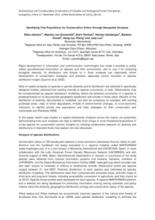
This review paper evaluates the potential of remote sensing for assessing landscape and species diversity in mountainous terrain.
Rapid development of information and communication technologies has made it possible to easily collect georeferenced information on species and their environment, and to use it for analyzing biological diversity, its distribution and threats to it.
Нумерация страниц
Land Library Search
Through our robust search engine, you can search for any item of the over 73,000 highly curated resources in the Land Library.
If you would like to find an overview of what is possible, feel free to peruse the Search Guide.


