Discover hidden stories and unheard voices on land governance issues from around the world. This is where the Land Portal community shares activities, experiences, challenges and successes.
 Follow our
Sustainable Development Goals
Blog Series!
Interested in land corruption?
Follow our Land & Corruption Blog Series
for in-depth perspectives from the experts.
Issues
Geographical focus
This blog has originally been published by CABI at https://blog.cabi.org/2015/
Increasingly, governments and citizens in developing countries as well as development agencies are using information technology to improve governance, shape government-citizen relations, and reduce corruption. Despite this, we continue to be at the first phases of understanding how to best use these new data sources in anti-corruption work, as well as appreciating the challenges and limitations inherent in them.
UNLIKELY PARTNERS: BLOCKCHAIN & LAND SURVEYING INDUSTRY
OUTLINE
I. Introduction to Blockchain Technology
II. Overview of the Surveying Industry
III. Surveying and Blockchain
IV. Types of Blockchains
V. The Case for Blockchain in the Real Estate Industry
VI. Blockchain, Surveying, Land Registry and Cadastre
VII. Blockchain Registry Integration Levels
VIII. The Future of Blockchain for Real Estate
IX. Conclusion
APPENDIX
Glossary — Blockchain Terminology
Our sugar is made from sugarcane. And sugarcane is not planted in trees or in the air, it’s planted in the ground, in the soil, on land. It’s the bedrock of our investment.
—Illovo Land Champion
Earlier this year, in honor of International Open Data Day, which took place on March 2nd, we put out a call, asking Land Portal users and any and all interested to submit their very own data stories to the Land Portal. What we were looking for were stories that were unique and original, and that presented data in innovative and engaging ways. We realized that this was no easy feat, but each and every one of the submissions we received made inventive use of photos, quotes, maps and infographics to tell compelling stories. In the end, the be
June 3, 2019
Read the original blog here.
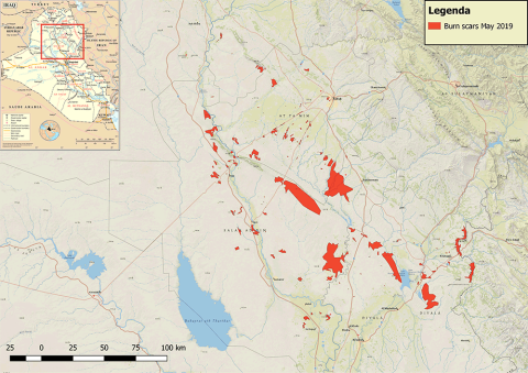
In early May 2019, it was reported that agricultural areas of central and northern Iraq were being set ablaze — allegedly by remaining pockets of fighters from the so-called Islamic State.
Introduction
The Deforestation and Forest Degradation in the Amazon Biome map was produced by Imazon in order to contribute towards monitoring in the region. The methodology applied simultaneously generates mapping of deforestation and forest degradation [caused by logging activity and forest burning] using Landsat satellite images. Existing methods individually detect and map those processes, which can lead to overlaps in the results and increasing uncertainty in estimates of annual deforestation rates.
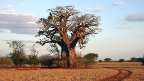
Trees have become an iconic image of environmentalism, but that doesn’t necessarily mean we should plant millions of them.
By Chris Hufstader
After an audacious land grab by a foreign company, indigenous women in a remote Cambodian village struggle to regain their farms and sacred sites.
Sol Preng remembers vividly the day in 2012 when bulldozers unexpectedly arrived on her family farm.
“The company came and cleared away our cashew trees right before the harvest,” she says. “I lost four hectares of land and all my cashew trees.”


