/ library resources
Showing items 1 through 6 of 6.
Almost one-quarter of the world’s land area has been degraded over the past 50 years because of soil erosion, salinization, peatland and wetland drainage, and forest degradation.
Mapping Together helps people use Collect Earth mapathons to monitor tree-based restoration. Collect Earth enables users to create precise data that can show where trees are growing outside the forest across farms, pasture, and urban areas and how the landscape has changed over time.
Community land, crucial to rural livelihood around the world, is increasingly targeted by commercial interests. Its loss can lead to environmental degradation, increased rural poverty and land disputes that last for years.
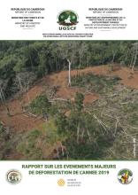
Dans le cadre du Suivi du Couvert des forêts du Cameroun, le Ministère des Forêts et de la Faune (MINFOF) et le Ministère de l’Environnement, de la Protection de la Nature et du Développement Durable (MINEPDED) par le biais de l’Unité Opérationnelle de Suivi du Couvert Forestier (UOSCF) en

Esse relatório apresenta as conclusões da análise custo-benefício para garantir a proteção das áreas florestais
indígenas na bacia amazônica da Bolívia, Brasil e Colômbia. Esses países foram selecionados principalmente

This research forms part of a larger study on large-scale land acquisition in Uganda.
Land Library Search
Through our robust search engine, you can search for any item of the over 73,000 highly curated resources in the Land Library.
If you would like to find an overview of what is possible, feel free to peruse the Search Guide.