page search

Issues land records related Blog post
There are 223 content items of different types and languages related to land records on the Land Portal.
Displaying 1 - 12 of 17

Webinar Recap: the Digitization of Land Records: A Panacea for Land Conflicts

05 March 2024

Organized by the Cadasta Foundation,  Land Conflict Watch,  the Land Portal Foundation, National Council of Applied Economic Research (NCAER) of India, and NRMC Center for Land Governance, the webinar "The Digitization of Land Records: A Panacea for Land Conflicts" provided an in-depth look at the critical role digitization of land records plays in addressing land disputes in India.

Exploring the Implications of Supreme Court Ruling on 72,000 Acres of Prime Land in Ghana's Capital: An Analysis of Land Tenure Security

14 December 2023
James Twumasi Appiah

Ensuring secure land tenure is crucial for improving land development, as both local and foreign investors often hesitate to engage in land transactions when there is uncertainty about ownership rights. The term "Land Tenure Insecurity" refers to the apprehension that someone else might claim ownership of the purchased land in the future, creating a significant risk for investment. This phenomenon is particularly common in the Sub-Saharan African Region of which Ghana is no exception. The positive impact of land tenure security is far-reaching.

Unleashing the Data Revolution: Empowering Land Governance through Open Metadata

25 July 2023
hybridauth_Google_112436478320262270252
Charl-Thom Bayer
Laura Meggiolaro

A new publication titled "The Role of Metadata and Open Data in the Innovation Cycle of Land Administration" puts the spotlight on this dynamic domain. This publication offers valuable insights into the significance of open data and structured metadata, and how they can revolutionize land administration processes worldwide. By delving into the core principles of open data and metadata, this publication offers a comprehensive understanding of how these tools can be leveraged to foster innovation and drive positive change in the land governance sector.

How to get displaced Ukrainians back into their housing, land and property quickly

05 October 2022
Yuliya Panfil
jon unruh

By Yuliya Panfil, Jon Unruh and Michael Cholod

Seven months have passed since Russia invaded Ukraine, displacing more than 13 million people—one-third of the country’s population—and leveling entire towns. 

And yet, despite all odds, Ukraine is turning the tide against its more powerful neighbor. Ukrainian forces have staged a rapid counter-offensive, liberating thousands of square miles of territory that displaced Ukrainians are beginning to return to.

Addressing gaps and challenges in SVAMITVA

07 July 2022
Gaurika Chugh

The celebration of National Panchayati Raj Day marks a redefining moment in the Constitutional history of India to invigorate and strengthen grassroot democracy in the country, through the institution of Panchayati Raj (73rd Amendment) Act, 1992. This day is also remarkable as on 24th April 2020, the Government of India launched a central sector scheme, Survey of villages and mapping with improvised technology in village areas (SVAMITVA). Through implementation of this scheme, GoI aims at formalization of land tenure in the abadi (inhabited) area.

'You Cannot Live Here'

20 April 2022
Nicholas Parkinson

USAID is supporting the government with a strategy to create municipal land offices that manage local land administration campaigns and deliver land titles to rural Colombians


Kenya’s Digitization of Land Records Enhances its Capacity to Monitor and Report Progress on National, Regional and Global Development Commitments

16 March 2022
ClintonOmusula
Paul Wanjama

In April 2021, Kenya, through the Ministry of Lands and Physical Planning (MoLPP) and the National Land Commission (NLC) achieved an unprecedented milestone in land management and administration by launching the National Land Information Management System (NLIMS) dubbed Ardhisasa.

Budget 2022: Land Records Modernization 2.0 reforms in India

03 February 2022
Gaurika Chugh


The Budget 2022 has introduced key reforms in land records management that highlights the adoption of an unique land identification number that in turn will be linked to the National Generic Document Registration System (NGDRS) that aims to adopt a pan-India uniform process for registration of deeds and documents. It will be interesting to see how this top-down land records management 2.0 reforms fits within the constitutional and federal framework of the country and addresses the issues of land administration in India.

The Perceived Conflict Between Open Data and Privacy Concerns in India

17 November 2021
Charl-Thom Bayer


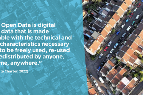
The good governance of land is critical to the pursuit of sustainable development. Given that the land sector is often considered to be susceptible to corruption, open and transparent land data is seen as an opportunity to fight corruption. Following global trends, the land sector is increasingly engaging in efforts to make more land and spatial data open and freely available. 

Top 3 Challenges in Opening Up Land Data, excerpt from the Revised Open Up Guide to Land Governance

25 October 2021
Charl-Thom Bayer
Laura Meggiolaro
The excerpt highlights the top three challenges any government faces in opening up their land data. Navigating these challenges is a top priority for the Land Portal as we begin to collaborate with national governments to put the Open Up Guide into practice.

A Student-Tryst with Land Matters : An Internship on Digital Land Records

13 September 2021
Pranab Choudhury
Prasad Avinash Pathak

How much land matters to each of us as citizens, students and faculties, and how much we know about them? Is it too complex to ignore, something that matters to us as property, identity or even as a stratum of lives and base of development, to a handful of bureaucrats, lawyers or surveyors? 

Here is a student internship, jointly designed by FLAME University, Pune and a land think tank – Centre for Land Governance, that shows why land matters more now and if and how students can also familiarise themselves and analyze land issues that are important to their lives and that of others.

During the initial interaction, all the girl students, who had joined the internship, were intrigued by a question specifically asked to them, “How many of you are aware of your or your mother’s name in your family land records?”. This question made them think of women's land rights and narrate their stories around that, which were not much different from the patriarchal rural India. The students slowly started realising the importance of land records in the context of enshrined legal equality. 

Land as a discipline critically resonates with environmental studies, economics, law, sociology, anthropology and political science as well as to applied disciplines like public policy, business management or geospatial technology etc. However, it is hardly studied and occasionally researched in Universities, B-Schools and technology institutes. That remains a fact, despite the challenges these institutions face in getting land for their own utilization and others having issues for their own properties. 

Not one student was even aware of what a land record looks like. Yash, a 4th year student majoring Public Policy said, “maybe we have seen it but not sure what it includes”. Many of them studied Geographic Information Systems (GIS) but they were never aware how that has been used in India’s land record digitisation program and if their skills make them read these records better?

Land is continued to be looked at as a complex and contested space that the common man should avoid engaging with, even when its importance as a crucible of development and asset for economic growth is on rise. Academic engagements can also flow with the current. Generating information and evidence that make policy, practice and interaction with land easier, less contested and more rewarding are rare and hardly pursued in universities.

However, with a week’s training, the students were able to learn the basics of land governance. Once they started accessing and interpreting digital land records, interesting observations came flowing in.  For Rahul, a 4th year student with Economics as a major, it was fun to explore terms like “Khewat, Khasra, Khatauni, Khata and Khatiyan and to understand which is a subunit of what and which is a synonym?” For example, Esha, a 4th year Environmental Studies student noted to her dismay that “Women landowners are rare, and when they exist, they are hardly the only owner of the land”. She kept wondering why women always owned much less land than men and also made their own property jointly with men. Aditi, another student, observed “even in a village occupied by Gond, a dominant tribe of Central India, the women landowners’ scenario does not change.” She spent time separating female landowners, by reading and comparing each name, as no gender column was there in the on-line land record portal.

Through this internship, the concept of presumptive titling, prevalent in India, was also discussed and understood by the students and faculty members. Under this system, legacy records like historical transactions viz old survey records or inheritance records also count as evidence and the onus remains on the owner to prove the ownership. Traditionally, various documents related to land records are created and maintained by different departments e.g. The Revenue department deals with tax and mutation, whereas the registration office deals with sale deed registration and transfer of ownership, while land records and survey departments create and deal with the maps. Many times such offices do not even communicate with each other to keep the records updated. Ground verification process suffers from weak human resources. While comparing the textual (RoR) with spatial (cadastral maps)  records and with on ground (google earth images) situations, students could observe such differences. They could realize how and why such discrepancies and disputes accompany land records.

As competitive demand and financial options around land grow and ‘ease of doing business’ require easy and fast land transactions and dispute resolution, moving towards a conclusive titling system is voiced by the government. In 2008, the Department Land Resources, Government of India, started implementation of “National Land Records Modernization Programme” (NLRMP) to computerize the records and develop transparent data. Later, it got revamped under “Digital India Land Records Modernization Programme” (DILRMP). The objectives of the programme were (i) to have a single window to access both, spatial and non-spatial data, (ii) make the data as true to the ground reality as possible – real time updating, (iii) to implement “curtain” principle where records of the title are true depiction of the reality and mutations are automated and (iv) title insurance.  In their pursuit to understand and analyse DILRMP progress in different states, they not only did get impressed with the quantum of work  done and their online availability, but also had challenging experience around access and incongruity.

For the internship work, the students looked at intra-state district-wise progress of DILRMP implementation in seven states around computerization of land records, digitisation of cadastral maps and resurvey in DIRLRMP website while taking care to check the claims by visiting respective state land record sites, where they are actually available. For a 3rd year student of Environmental studies, Pranaay it was a tough time in accessing usable information from state sites. “We faced difficulty in getting geospatial information and contacting the government officials also did not help as they were unaware of this kind of information”, he says while exploring the cadastral map. Faculties and guides from both institutions, had to extend their imaginations to help students in getting access to and retrieve right information. 

A common finding was that despite good progress of computerisation of textual records, the spatial or mapping component have remained a challenge. For example, Manya and Devanshi, also Environmental Studies students, noticed that “there are no geographic coordinates present on the Bhunaksha site” for maps of villages for Bihar. Esha and Karishma, found some RoR links returning blank pdf files in the state of Chhattisgarh, which was found to be having accessible websites with easy interfaces. Being students from Pune, Sayali and Aditi, were surprised to see Amaravati district doing well where has Satara remained at the bottom, in Maharashtra, in terms of a computerisation  index they developed combining progress and comparing the digitisation parameters reported in DILRMP vs that is available in state sites. 

As they went through relevant government websites such as Bhulekh, Bhunaksha, Bhumanchitra, Bhuvan Panchayat, Census and PMKisan etc. to access textual, spatial records, village maps and demographic, land use and direct benefit transfer to farmers’ data, it was both a learning experience as also a game of patience for them. Pranaay and Rahul had to keep spending hours struggling to get useful information from Jamabandi site for Haryana, while for Esha and Karishma working on Chhattisgarh it was a cake walk. Thriptha, a 4th year student now said “I was not aware of so many Government Departments, their rich data availability and about the land records before joining the internship.”   

These datasets were used  by Interns to analyse the land ownership, distribution and land record matching status at village level. Exploring village specific data from Census and matching with land record data, they could see how caste, gender and class relations impact land ownership and landlessness. Sayali could understand the importance why digital land portals should provide caste and sex-segregated data around land ownership. In a village, with very few land owning farmers, she was surprised to find many PMKisan beneficiaries.

In spite of their harrowing experience many of them appreciated the digitization initiative to map and document such a large country. However, almost all of them were disturbed to witness the gender and caste inequity in terms of land ownership as well as land concentration with a few households in almost all villages. 

As student researchers now they have many insights and opinions on digital land records, e-governance, technology-society interaction and more importantly how government works? Yash, Pranaay and Rahul are now in a position to suggest technological improvements in the government websites that can help seamless access. The cherry on the icing was when Prof Narayanan from Azim Premji  said “students have carried out a good preliminary research at such a granular level. No university in the country has been engaged in this critical area which is tightly linked with the future economy. Congratulations to the team!”