


The Land in Peace project, led by Kadaster in collaboration with the Government of Colombia, highlights the use of the Fit-For-Purpose methodology for land administration in rural territories affected by the armed conflict.
Introduction
In 2016, the Colombian government signed a Peace Agreement with the FARC guerrilla. The first chapter of this document, the Integral Rural Reform, proposes a transformation of the rural areas to generate highly needed improved structural socio-economic conditions for Colombian peasant families and the rural society at large. One of the crucial components of these policies is land access and land use, which contributes to democratizing access to land, legal security and participation in the formal economy, including access to bank credit and government programmes on extension, credit, marketing and rural housing, among others.
In this Integral Rural Reform, Colombia's government aims at redistributing three million hectares of land, formalizing seven million hectares and updating the national cadaster coverage by 2026. However, if conventional land administration is used by the government, these goals will not be achieved.
To achieve these objectives, it is necessary to change the process used to formalize land in Colombia. For this reason, Kadaster, The Netherlands' Cadastre, Land Registry and Mapping Agency, as part of the Netherlands' cooperation with Colombia proposed the implementation of Fit-For-Purpose (FFP) methodology, an approach developed by the World Bank and FIG, and adapted to the Colombia rural land condition, to promote more efficient, accessible, and rapid land administration.
Archive: Land in Peace project, Kadaster. Photo by Sebastian Rosas
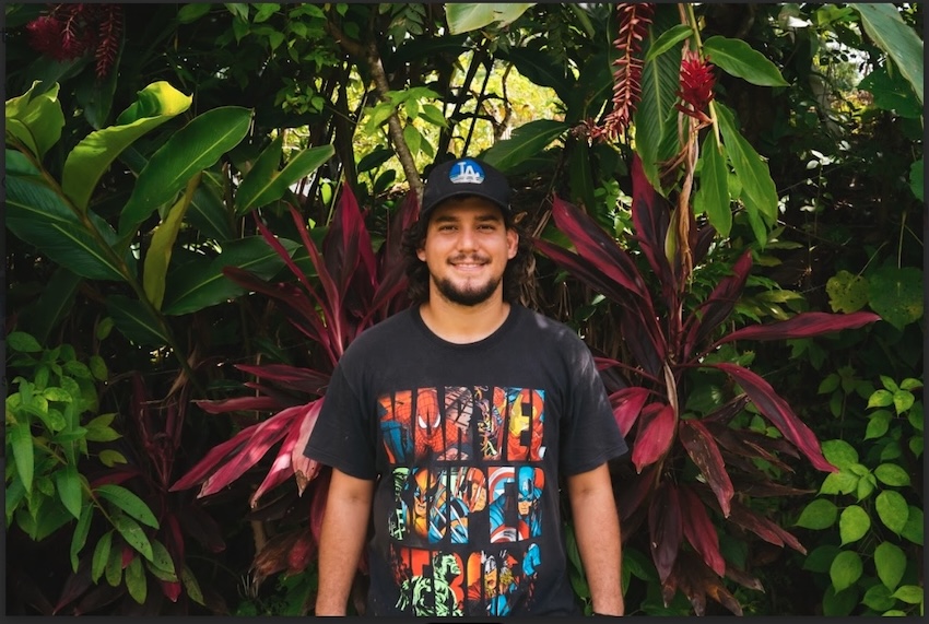
“When they gave me the title, it was very gratifying, one of my dreams came true to have a land title. In two years, I dream [of] ecotourism through hiking and bird watching programs.”
Elver Borja, Land Title Beneficiary of the El Tigre’s village.
Elver and his father were beneficiaries of the Land in Peace project, a Colombian-Dutch cooperation project, which has promoted the FFP approach to land administration, to achieve the goal of recognizing the property rights of the country's small producers, especially in post-conflict areas.
Fit-for-Purpose methodology applied in Colombia
This project was led by Kadaster International, who, in collaboration with the Colombian institutions, designed a FFP methodology based on the Colombian reality, which aims at reducing the time required by the cadastral and land registration processes, increase community participation and the appropriation of new technologies to contribute to the achievement of the land formalization objectives set out in the Peace Agreements.

Steps of the FFP methodology application for Colombian rural settings.
The community's collaboration was an essential component of the methodology in Colombia. To begin, Kadaster team spoke with the Communal Action Boards, and through social cartography and dialogue with those who know the territory, we established a work plan that allows us to collect the necessary information in the cadastre and registration processes.

Archive: Land in Peace project, Kadaster. Photo by Sebastian Rosas
"What was accomplished during the measurement process was beneficial, because most of the owners just had a “purchase and sale document”, a document without legal status. So, when they learned about this project, the owners were very enthusiastic because they would have a land title."
Windy Cartagena, resident of the town of La Balsa, Apartado.

Archive: Land in Peace project, Kadaster. Photo by Sebastian Rosas
“The technicians from the Dutch Cadastre helped us to obtain a very good opportunity to legalize our land. The title was a huge joy for me and my neighbors”.
Gabriel Gonzalez, Land Title Beneficiary of the El Tigre’s village.
Windy and Gabriel were two participants in Kadaster's Land in Peace project, where community dialogue and involvement are essential components of the FFP methodology.
Afterwards, we trained the grassroot surveyor in the use of GPS equipment and cell phone applications, which they used to collect the information related to the property. These surveyors walk the boundaries of the property together with the owner or tenant, collecting basic information regarding the property, the documents indicating the relationship between the property and the possessor, the rights, and the personal identity of the person concerned.
An example of the community involvement is Yhojan Giraldo, a young who measured his parcel and his neighbors, after this training, in the Village el Batan, in Hobo, Huila.

“I encourage all young people to take the initiative to measure their own land. It’s a straightforward process that allows you to gain a profound understanding of your property and, in turn, provides assistance to others in doing the same”.
Yhojan Giraldo, Grassroot surveyor and coffee farmer.
The public inspection is a socialization event, where neighbors and interested parties can see the results of the measurements and agreements are established and registered between neighbors through a digital signature. Advancements in technology produce neighboring certificates (Actas de colindancia), which are necessary for the formalization procedures carried out by cadastral government agencies.
“It is essential to involve communities in land administration processes, this generates transparency and trust among the beneficiaries.”
Laura Becerra. Local project director of Land in Peace.
GNSS equipment and specialized software were used for the FFP land administration approach in Colombia. For the data collection, Esri’s Field Maps app was tested and improved based on the FFP LA field experiences by software developers of Esri Inc. and Esri Colombia. For the public inspection of the collected data, an open source web app was developed by ITC Twente and the District University of Bogota.
Conclusion
The collaboration with Colombian cadastral institutions allowed us to apply this methodology in various municipalities and communities with a wide range of characteristics. The results allowed us to develop lessons learned and recommendations to improve Colombia's land administration system.
One of the lessons learnt emphasizes the significance of making institutional and legislative changes to reduce bureaucracy and promote community participation in land procedures. It is also proposed that procedures be devised to encourage the preservation of formality in rural areas.
As part of the Land in Peace project, we left our learnings to the Colombian institutions that participated in multiple trainings, as well as field experiences. This also included the participation of higher education institutions, where new professionals will have the opportunity to learn and apply new methodologies.
The Land in Peace project closed in March 2024, having influenced the flexibility of existing formalization processes and having promoted community participation in land administration in Colombia. Meanwhile, the LAND-at-scale project operated by Kadaster, together with two Dutch NGOs, with a focus on ethnic communities, continues to apply the FFP approach.
As a result, we welcome you to consult and use the toolkit, it provides a step-by-step description of the FFP approach in practice, which can be adapted to different local situations.
****
Many publications and other resources from this project can be found on the Land Portal, on the page dedicated to the LAND-at-Scale Colombia project.