Missed an interesting event or property rights? Find out the headlines and information about any past events or conferences.
Residential workshop on Land Governance and Development

To equip development practitioners with better and nuanced understanding of land and development connections, Azim Premji University, Bengaluru and the Centre for Land Governance, Bhubaneswar are organising a five-day residential workshop from 3 July–7 July 2023.
IOS-Fair Transitions-LANDac International Conference 2023

We are happy to announce the joint IOS-Fair Transitions-LANDac International Conference at the crossroads of the fair transitions and land governance debates in the context of climate change. The conference is structured around the joint challenge of finding ways to make transitions fair and inclusive, for human and non-human life.
The State of Land Data: Transforming Africa Into a Powerhouse of the Future

This webinar aimed to build the capacity of researchers and practitioners across Africa to better understand sustainable approaches to land data governance. The webinar highlighted the importance of good land data governance for improving property rights and enabling more efficient government services.
Mainstreaming land rights of the rural poor in the climate discourse: Side event

The aim of this event is increasing public understanding of the links between climate change, disasters, and land tenure rights, and bringing land tenure issues in the climate change discourse, listening particularly to the voices of civil society and youth. The discussion is also expected to bring forth some ideas for action both for the new GFAR Collective Action on land tenure and climate change, and for policy makers.
FIG Working Week 2023
When our global community unites, the energy is unstoppable. That’s why FIG and the local organisers, NSPS, are thrilled to invite you for the FIG Working Week 2023. Look forward to an exciting week-long conference that brings the international community of surveying and spatial professionals together to experience a mix of interesting technical sessions and workshops, a trade exhibition and a variety of side events and social functions.
Indigenous Land Rights and the Biodiversity COP15: Six Months On

After two weeks of tense talks, the recent UN Biodiversity Conference COP15 ended with a landmark agreement to guide global action on nature through to 2030. The Kunming-Montreal Global Biodiversity Framework (GBF), includes concrete measures to halt and reverse nature loss, including putting 30% of the planet and 30% of degraded ecosystems under protection by 2030.
Application of NASA SPoRT-Land Information System (SPoRT-LIS) Soil Moisture Data for Drought
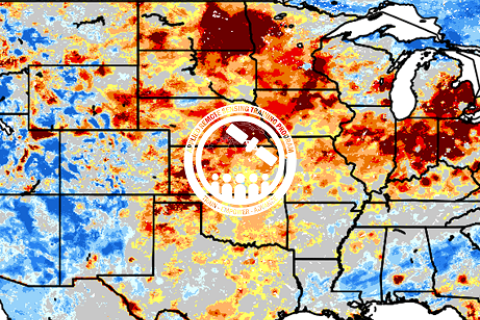
NASA’s Applied Remote Sensing Training Program (ARSET) has opened a new open, online webinar series: Application of NASA SPoRT-Land Information System (SPoRT-LIS) Soil Moisture Data for Drought. This 3-part webinar series is focused on the introduction of the NASA Land Information System (LIS) output of soil moisture at various depths for drought analysis and monitoring. Examples from operational applications as well as practice exercises (for using LIS data for drought monitoring) will be included in this course. Access to the SPoRT-LIS products via online viewer, in GIS formats, and GIS-based display tools, will also be included. Moreover, self-paced microlessons will be available to help users confirm their understanding and improve their skill via homework lessons between live sessions.
Regional webinars on integrating land tenure into restoration initiatives

These webinars aim to raise awareness on the value of tenure security and its contribution to biodiversity conservation, sustainable land management, ecosystem restoration, and climate change mitigation and adaptation while improving food security and local livelihoods.
Introducing the State of Land Information Index

This side event will serve to introduce the Land Portal’s State of Land Information Index (SOLIndex), which measures openness of land data at the country and global level. The aim of this index is to make land-related findings more actionable and to complement existing land governance monitoring systems, such as tools developed by GLTN. The SOLIndex provides an overall indicator that assesses the openness of land data and information at global and country levels. The SOLIndex can be used as a diagnostic and advocacy tool for making land data more open and inclusive in support of good land governance.
This side event will explore the range of indicators that constitute the index, explore strengths, weaknesses, opportunities and threats of the collection of these indicators in an effort to obtain and incorporate feedback from GLTN Partners into the process of validating the indicator.
Through the Land Data Lens – What are we seeing/Not seeing?

The objectives of this session are to highlight national, regional and global progress and accomplishments in outcome 3 of phase 3 of the GLTN program, to gather feedback from GLTN partners and receive proposals on the monitoring focus in phase 4, and to identify potential collaborative opportunities with GLTN partners to upscale monitoring of the land agenda.
9th GLTN Partners Meeting 2023

The 9th GLTN Partners’ Meeting 20203 will focus on the lessons learnt from Phase 3 and reflect on the way forward towards Phase 4 of the GLTN programme.
Measuring the state of data for public good and the achievement of the SDGs [UN World Data Forum Side Event]
As the deadline for the Sustainable Development Goals and Agenda 2030 approaches, the need to monitor progress on the development goals could not be clearer, as is the need to assess the role of data in advancing toward the goals.