Ce document de travail entend parcourir l’évolution historique et faire un état des lieux des concepts et des outils à la base de l’évaluation des terres et de l’aménagement du territoire pour la gestion des ressources foncières et des paysages, et proposer par là-même des recommandations pour…
This new Guide describes the application of spatial technology to improve disaster risk management (DRM) within the aquaculture sector. DRM requires interrelated activities to ensure prevention, preparedness (including early warning), response and recovery for a wide range of natural,…
This new guide describes the application of spatial technology to improve disaster risk management (DRM) within the aquaculture sector. DRM requires interrelated actions and activities to ensure early warning, prevention, preparedness, response and recovery for a wide range of natural,…
This new guide describes the application of spatial technology to improve disaster risk management (DRM) within the aquaculture sector. DRM requires interrelated actions and activities to ensure early warning, prevention, preparedness, response and recovery for a wide range of natural,…
The Mediterranean region has more than 25 million hectares of Mediterranean forests and about 50 million hectares of other Mediterranean wooded lands. They make crucial contributions to rural development, poverty alleviation, food security, as well as, the agricultural, water, tourism, and…
The integration of food into urban planning is a crucial and emerging topic. Urban planners, alongside the local and regional authorities that have traditionally been less engaged in food-related issues, are now asked to take a central and active part in understanding the way food is produced,…
Small-scale fisheries play a key role in ensuring food security and eradicating poverty. However, the overall development of the fisheries sector, as well as increased pressure from other sectors (e.g. tourism, aquaculture, agriculture, energy, mining, industry, infrastructure developments) with…
There are many methods to estimate wild ungulate populations. One of these is represented by observations from vantage points usually employed in medium-low covered forest areas to estimate cervids. This method is subject to some limitations, such as the risk of double counting and the necessity…
With the purpose to study a solution based on Sustainable Urban Drainage Systems (SUDS) to reduce and treat stormwater runoff in urban areas, a bioretention pond (BP) was realized in the Agripolis campus of the University of Padova, Italy. The BP collected overflow water volumes of the rainwater…
Nature-based recreation is among the most relevant ecosystem services supplied by urban green infrastructure, affecting citizens’ physical and mental wellbeing. Providing adequate green spaces for nature-based recreation is among the main goals of urban planning, but commonly-used indicators…
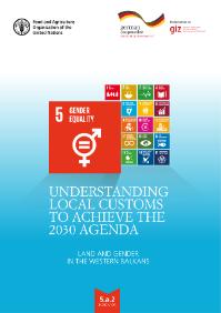
FAO and the Deutsche Gesellschaft für Internationale Zusammenarbeit (GIZ) GmbH have been providing support to the Western Balkans region to promote progress on Gender Equality, with a focus on measuring the proportion of countries where the legal framework guarantees women’s equal rights to land…
The material compiled, which covers over 2 000 international legal intruments stretching from the year 805 to 1977, has been organized chronologically and tabulated with an indication, for each instrument, of the substance covered and of the water bodies, territories and basins concerned,…


