Aller au contenu principal

page search

Displaying 61 - 72 of 586

Assessing the relationship between land tenure issues and land cover changes around the Arabuko Sokoke Forest in Kenya

LandLibrary Resource
Peer-reviewed publication
Mai, 2020
Kenya
Norvège

Land as an essential resource is becoming increasingly scarce due to population growth. In the case of the Kenyan coast, population pressure causes land cover changes in the Arabuko Sokoke Forest, which is an important habitat for endangered species.

Quantification of Soil Losses along the Coastal Protected Areas in Kenya

LandLibrary Resource
Peer-reviewed publication
Mai, 2020
Kenya

Monitoring of improper soil erosion empowered by water is constantly adding more risk to the natural resource mitigation scenarios, especially in developing countries. The demographical pattern and the rate of growth, in addition to the impairments of the rainfall pattern, are consequently disposed to adverse environmental disturbances.

Land Governance Lost in Translation - Exploring Semantic Technologies to Increase Discoverability of New Technologies & Data

LandLibrary Resource
Peer-reviewed publication
Avril, 2020
Global

Language and technology barriers are a very serious constraint to effectively exchange and learn from land data, information and technologies across the globe. We would like to explore whether we can gain inspiration from how semantic web technologies have overcome knowledge-sharing challenges in other sectors, such as the agriculture sector.

Quantification of Erosion in Selected Catchment Areas of the Ruzizi River (DRC) Using the (R)USLE Model

LandLibrary Resource
Peer-reviewed publication
Avril, 2020
Democratic Republic of the Congo

Inappropriate land management leads to soil loss with destruction of the land’s resource and sediment input into the receiving river. Part of the sediment budget of a catchment is the estimation of soil loss.

Detecting Land Abandonment in Łódź Voivodeship Using Convolutional Neural Networks

LandLibrary Resource
Peer-reviewed publication
Mars, 2020
Poland

The wide availability of multispectral satellite imagery through projects such as Landsat and Sentinel, combined with the introduction of deep learning in general and Convolutional Neural Networks (CNNs) in particular, has allowed for the rapid and effective analysis of multiple classes of problems pertaining to land coverage.

Towards an open up guide on land governance

LandLibrary Resource
Conference Papers & Reports
Février, 2020
Global

This report provides a summary of an online workshop on March 16th 2020, organised in place of a planned fringe meeting of the World Bank Land and Poverty Conference which was cancelled due to the COVID-19 pandemic. The 2-hour digital workshop brought together over 40 participants from across the world to discuss key data and key open data use-cases for land governance.

The State of Support for Open Data in Land Governance

LandLibrary Resource
Reports & Research
Novembre, 2019
Global

This September, the Land Portal hosted an online dialogue on ‘Open Land Data in the Fight Against Corruption’. This responded to a dual recognition that corruption remains a major issue in land governance, and that open data has been identified as a powerful tool in the fight against corruption. At the same time, gaps remain between the promise and the reality of open data in the land sector.

Land use optimization tool for sustainable intensification of high-latitude agricultural systems

LandLibrary Resource
Peer-reviewed publication
Octobre, 2019
Finlande
Norvège

Recent studies assessing agricultural policies, including the EU’s Agri-Environment Scheme, have shown that these have been successful in attaining some environmental goals. In Finland, however, the economic situation of farms has dramatically fallen and hence, the actions do not result in social acceptability.

Land-Use and Land-Cover (LULC) Change Detection in Wami River Basin, Tanzania

LandLibrary Resource
Peer-reviewed publication
Septembre, 2019
Tanzania

Anthropogenic activities have substantially changed natural landscapes, especially in regions which are extremely affected by population growth and climate change such as East African countries. Understanding the patterns of land-use and land-cover (LULC) change is important for efficient environmental management, including effective water management practice.

Using Farmer Decision Rules for Mapping Historical Land Use Change Patterns from 1954 to 2007 in Rural Northwestern Vietnam

LandLibrary Resource
Peer-reviewed publication
Septembre, 2019
Viet Nam

The present study revealed how local socioecological knowledge elucidated during participatory rural appraisals and historical remote sensing data can be combined for analyzing land use change patterns from 1954 to 2007 in northwestern Vietnam.

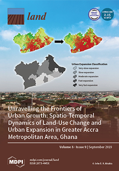
Unravelling the Frontiers of Urban Growth: Spatio-Temporal Dynamics of Land-Use Change and Urban Expansion in Greater Accra Metropolitan Area, Ghana

LandLibrary Resource
Peer-reviewed publication
Septembre, 2019
Ghana

This study analyzed and assessed spatio-temporal dynamics of land-use change (LUC) and urban expansion (UE) within the Greater Accra Metropolitan Area (GAMA) of Ghana. This region serves as a case to illustrate how a major economic hub and political core area is experiencing massive spatial transformations, resulting in uneven geographies of urban land expansion.