By 2050, two-thirds of people worldwide will live in urban areas. Many city dwellers in the global South live in informal settlements, without access to basic services. The global Sustainable Development Goals seek to redress this inequity with an overarching aim to ‘leave no one behind’. This…
Community sourced land information influencing national upgrading projects in Colombia, Kenya, Philippines and Uganda: Evidences where the top-down and bottom-up approaches meet
Community sourced land information influencing national upgrading projects in Colombia, Kenya, Philippines and Uganda: Evidences where the top-down and bottom-up approaches meet
This guide explores the legal dimensions of responsible governance of tenure. It supports the application of the Voluntary Guidelines on the Responsible Governance of Tenure for Land, Fisheries and Forests in the Context of National Food Security at the national level. The guide addresses the…
This Order, consisting of 11 sections, adopts the Digital Land Survey Data (DLSD) as a Standard Format for the Submission and Exchange of Survey Data in Digital Form under the Land Administration and Management System (LAMS). The use of DLSD aims to improve the services of all Regional Offices…
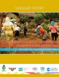
This publication is a summary report of the <a href="http://angoc.org/news/asia-regional-forum-on-land-administration-and-management-in-r…;“Asia Regional…
Forest tenure reform has no doubt attained significant gains in promoting social justice and equity in the forest sector, through legal recognition of the communities’ property rights over forest lands in many developing countries. This includes the right to harvest and market trees that the…
The April 2015 edition of Against the Grain -- a report by Genetic Resources Action International (GRAIN) on laws and mechanisms in Asia that result in land transfer from independent farmers to larger entities.
In spite of a growing interest in organic agriculture; there has been relatively little research on why farmers might choose to adopt organic methods, particularly in the developing world. To address this shortcoming, we developed an exploratory agent-based model depicting Philippine smallholder…
The integrated remote sensing (RS) and geographic information system (GIS) approach was utilized in this study to classify land use and land cover (LULC), detect changes based over time, and identify transition trends in the Marikina sub-watershed, Laguna de Bay watershed, Philippines. Landsat 5…
Geospatial information of small mangrove islands in the Philippines is usually lacking. Such information is vital to monitor mangrove cover change and craft plans for their sustainable management. This study was conducted to provide some land use information about Banacon Island in Bohol…


