page search

Displaying 61 - 72 of 284

Mapping Tropical Forest Biomass by Combining ALOS-2, Landsat 8, and Field Plots Data

LandLibrary Resource
Peer-reviewed publication
December, 2016
Vietnam

This research was carried out in a dense tropical forest region with the objective of improving the biomass estimates by a combination of ALOS-2 SAR, Landsat 8 optical, and field plots data. Using forest inventory based biomass data, the performance of different parameters from the two sensors was evaluated.

Large-Scale Mapping of Tree-Community Composition as a Surrogate of Forest Degradation in Bornean Tropical Rain Forests

LandLibrary Resource
Peer-reviewed publication
December, 2016

Assessment of the progress of the Aichi Biodiversity Targets set by the Convention on Biological Diversity (CBD) and the safeguarding of ecosystems from the perverse negative impacts caused by Reducing Emissions from Deforestation and Forest Degradation Plus (REDD+) requires the development of spatiotemporally robust and sensitive indicators of biodiversity and ecosystem health.

Integration of ALOS PALSAR and Landsat Data for Land Cover and Forest Mapping in Northern Tanzania

LandLibrary Resource
Peer-reviewed publication
December, 2016

Land cover and forest mapping supports decision makers in the course of making informed decisions for implementation of sustainable conservation and management plans of the forest resources and environmental monitoring. This research examines the value of integrating of ALOS PALSAR and Landsat data for improved forest and land cover mapping in Northern Tanzania.

أطلس المواقع المرجحة لتربية الأحياء المائية في الأقفاص بالبحر الأحمر

LandLibrary Resource
Policy Papers & Briefs
November, 2016
Saudi Arabia
Asia

A methodology was selected so as to provide a consistent and robust approach to using GIS for data capture, interpretation, storage and analysis. This included the capturing of new coastal and terrestrial data along the Red Sea coastline in the timescale of the project and at an appropriate scale to carry out the site selection study.

Base referencial mundial del recurso suelo 2014: Sistema internacional de clasificación de suelos para la nomenclatura de suelos y la creación de leyendas de mapas de suelos

LandLibrary Resource
Journal Articles & Books
November, 2016
France
United States of America
Luxembourg
Chile
Australia
Denmark
Netherlands
Poland
Bulgaria
Ghana
Argentina
New Zealand
Canada
Brazil
Austria

La tercera edición de la WRB incorpora, en el nuevo capítulo 2, elementos que permiten generar nombres taxonómicos mucho más informativos que llevan a deducir con facilidad la génesis y funciones de los suelos. Por otro lado, esta nueva versión de la WRB facilita la elaboración de leyendas de mapas a varias escalas para uso multifinalitario.

Urban Land Use Planning Monitoring And Oversight Guidelines

LandLibrary Resource
Manuals & Guidelines
November, 2016
Kenya

Cities and Urban Areas play a crucial role as engines of development as well as centers of connectivity, creativity, innovation, and as service hubs for the surrounding areas. Kenya has experienced unprecedented urban growth. At independence the urban population was about 8%. This had grown to be about 40% by 2015.

Historical perspectives on the future land uses of tsunami-affected areasThe case study of Hanagama District, Yamamoto, Miyagi

LandLibrary Resource
Journal Articles & Books
November, 2016

This study focuses on land use in the tsunami inundation area caused by the Great East Japan Earthquake, particularly land use history in the tsunami-affected area. Hanagama District, Yamamoto City, Miyagi prefecture, was selected as the study area. Land use were examined using aerial photographs taken in 1975, 2010 and 2013.

Training on GeoODK in Bangladesh

LandLibrary Resource
Conference Papers & Reports
August, 2016
Bangladesh

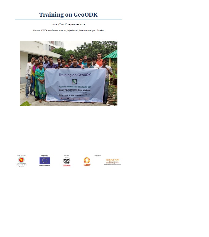
Training on GeoODK1 was held on 4th and 5th September 2016 at the YWCA2 in Dhaka to develop the staff capacity about the mobile base survey, analysis and presentation. The training was facilitated by Mr. Frank Pichel & Mr. David Palomino both of working in Cadasta.org as chief program officer & product owner respectively. Total eighteen staffs from Uttaran were attended the training.

Exploring Land Data

LandLibrary Resource
Reports & Research
August, 2016
United Kingdom
Global

Quality information on land is crucial to making good decisions about it. Increasing access to this information is important, and it is particularly vital to get it to groups who focus on social and environmental missions. This report is about the information needs of these ‘common good land users’, the data that is available, and how to get it to them.