Mapping global cropland and field size

LandLibrary Resource

Turkey is homeland of the grapevine (Vitis spp.), one of the most important agricultural products in the World. Our country, having the favorable climatic conditions for viticulture, has an important role among the viticulture farming countries of the World.
This publication is a revised and updated version of World Soil Resources Reports No. 84 and 103 and presents the international soil classification system. Every soil in the world can be allocated to one of the 32 Reference Soil Groups as defined in this document, and can further be characterized by a set of qualifiers.
Este Atlas proporciona información confiable y actualizada para el conocimiento de la cobertura del suelo en el Uruguay y el análisis de sus cambios a partir del año 2000. El objetivo del mismo es contribuir al monitoreo informado del territorio usando el Sistema de clasificación estandarizado LCCS (Land Cover Classification System) de FAO.

These guidelines provide a basis for engagement between the County Governments as planning authorities responsible for preparing, approving and implementing County Spatial Plans and the National Land Commission as a monitoring and oversight agency over land use planning.

Well before the effective ending of the protracted Lord’s Resistance Army (LRA)
insurgency in northern Uganda in July 2006, and at a time when the entire rural
population was displaced into camps, concerns had emerged around land, in particular
in the Acholi sub-region, where the war had been most intense and longest lasting
健康的土壤是满足粮食、生物质(能源)、纤维、饲料等产品不同需要的基本前提, 并确保在世界所有区域提供必要的生态系统服务。然而,人类正面临着前所未有的土 壤资源压力。特别是,各种类型的土地退化,包括快速城市化造成的土壤板结正在招 致沉重的代价,威胁着粮食安全和生态平衡。考虑到目前处于审议阶段并很快付诸实 施的可持续发展目标,必须从根本上保证土壤的可持续管理,才能让这些目标变为现 实
Здоровье почв является одним из главных условий, необходимых для удовлетворения разнообразных потребностей в продовольствии, биомассе (энергии), волокнах, кормах и других видах продукции, а также для обеспечения основных экосистемных услуг во всех регионах мира. Вместе с тем человечество сталкивается с беспрецедентным давлением на почвенные ресурсы.
Des sols sains sont une condition préalable essentielle pour satisfaire divers besoins en nourriture, biomasse (énergie), fibre, fourrage et autres produits; et pour assurer la fourniture de services écosystémiques essentiels dans toutes les régions du monde. Cependant, les ressources en sol de l’humanité sont confrontées à des pressions sans précédent.

The report, prepared by the Indian Environment Law Offices, offers insights on mainstreaming Shifting Cultivation or Jhum through innovative interventions, such as Participatory Land Use Planning into policy, legal and institutional framework in Nagaland and help the state realize its full development potential.
Land administration is a process of recording and disseminating information about the association between people and land. To administer land matters in Malaysia, the Department of Surveying and Mapping Malaysia uses eKadaster and Land Office has eTanah which are different in e-Systems.
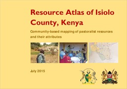
Participatory digital mapping using satellite imagery and digital earth and other open source Geographic Information Systems (GIS) is a practical tool bridging the knowledge and communication gap between pastoral communities and county government planners.