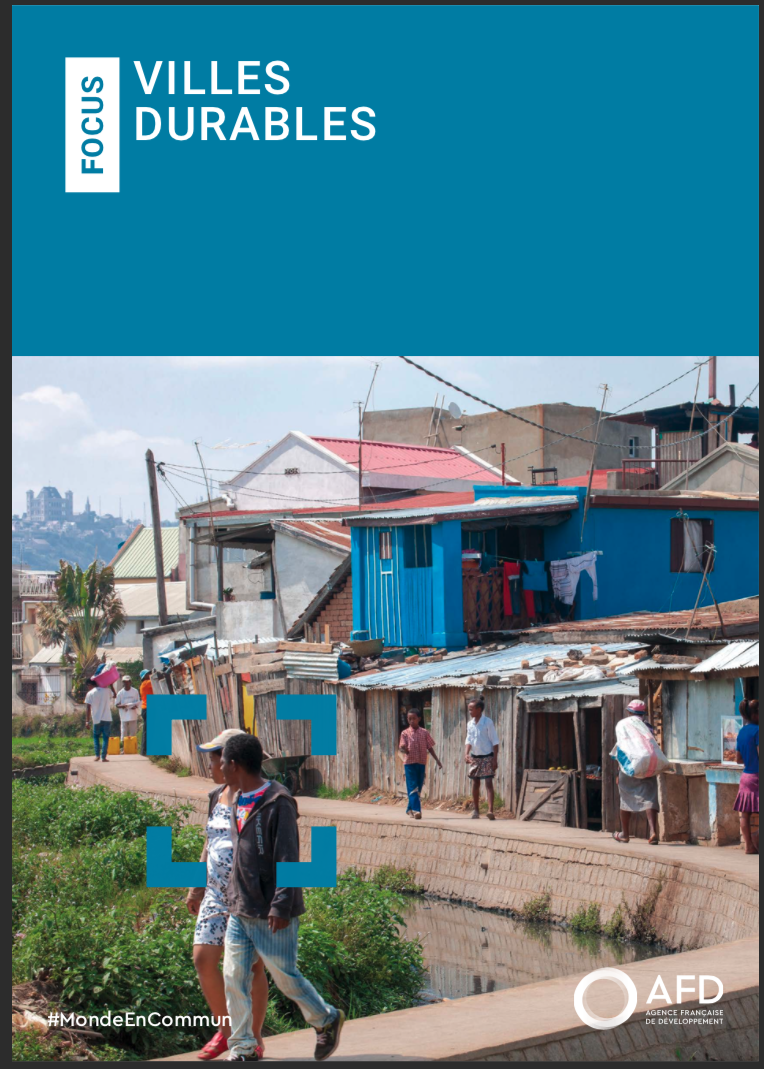
FOCUS VILLES DURABLES
Reports & Research
Janeiro, 2020
Global
L’AFD accompagne la transition bas carbone des v
L’AFD accompagne la transition bas carbone des v

The change in land use during the process of urbanization affects surface runoff and increases flood risk in big cities. This study investigated the impact of land use change on surface runoff in Beijing’s central area during the period of rapid urbanization from 1984 to 2019. Land use maps of 1984, 1999, 2009, and 2019 were generated by image classification of Landsat images. Surface runoffs were calculated with the Soil Conservation Service curve number (SCS-CN) model. Correlation analysis was used to identify the dominant factor of land use change affecting surface runoff.

The Absorption of rural Landscape by the process of urbanization is a critical issue leading to several, economic and environmental complications. Urbanization drives land use and land cover change (zoya et al., 2016), and, since the First Industrial Revolution (from about 1760 to 1840), has been characterised by the growth of urban population and spatial extension of cities. With the beginning of the twenty-first century, urbanization has gone hand in hand with development in emerging countries often leading to massive rural exodus.

The aim of this study is to review the literature and provide a technical brief to the African Group of Negotiators Experts Support (AGNES) on the effect of climate change on livestock across the continent up to 2050, highlighting the adaptation needs and options.
Under the Paris Agreement, countries should update their Nationally Determined Contribution (NDC) every five years, with progressive ambition in each new submission. Kenya plans to review and revise its NDC in June 2020. The State Department for Livestock has undertaken a stock-taking exercise with support from UNIQUE forestry and land use, CCAFS and GRA. This report summarizes the main findings and recommendations for the livestock sub-sector contribution to enhanced climate change ambition.
Overlooked in national reports and in conservation programs, wild food plants (WFPs)

Oran, deuxième grande ville d’Algérie, connaît un rythme d’urbanisation particulièrement soutenu ces dernières décennies. Il en résulte une consommation élevée de terres agricoles avoisinantes qui se poursuit à l’heure actuelle sous la pression massive de la production de logements et d’équipements dans la proche périphérie de la ville. Cette réalité est confirmée par les résultats obtenus à partir de traitements de télédétection appliqués sur une série d’images satellitaires.
We assess the spatial and intertemporal change patterns of farmland prices using per hectare minimum willingness to accept (WTA) sales and rental prices in Malawi. We use three rounds of nationally representative household farm panel data from the Living Standards Measurement Surveys (LSMS), collected in 2010, 2013 and 2016. We study price changes by splitting the sample in quintiles based on distance from the nearest major city, building on the von Thünen theory and urban growth model. Generally, WTA land prices decrease with distance from urban areas.

A wide variety of settlement systems exist, ranging from small villages to large metropolises. However, spatial analyses are typically confined to the mere presence or absence of built-up land and the changes therein, while more subtle differences between various settlement systems are ignored. In this paper we study the spatial distribution of Chinese settlements in terms of their built-up land, cluster density and cluster size, as well as their changes between 1990 and 2010.

The coordination relationship between land urbanization and population urbanization is crucial for achieving sustainable development under economic transition. Moreover, the balance between land urbanization and population urbanization is essential to guarantee the urbanization process of an entire city. This paper empirically analyzes the interaction between land urbanization and population urbanization in Nanchang from 2002 to 2017 based on the coupling coordination model (CCM).

ABSTRACTED FROM EXECUTIVE SUMMARY: Singapore’s present status of importing over 90 per cent of its domestic food consumption needs is a result of the city-state’s deliberate industrialisation policy to transform from third world to first over the past decades, reducing the farmlands for food production from about 15,000 hectares in the 1960s to about 600 hectares today to make room for higher value-adding industries.

The National Urban Assessment for Armenia provides a snapshot of the country’s urban sector and offers insights to achieving prosperous and sustainable cities. Armenia is highly urbanized, with the population concentrated in Yerevan and its surrounding areas given the capital’s geopolitical, economic, and cultural legacy. Opportunities exist to develop well-planned infrastructure along with balanced resource distribution among Yerevan and other cities, while leveraging Armenia’s cultural and environmental assets.