There are 3, 553 content items of different types and languages related to Administración de tierras on the Land Portal.
Administración de tierras
AGROVOC URI:
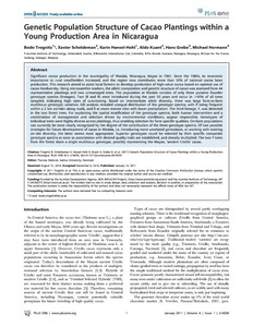
Genetic population structure of cacao plantings within a young production area in Nicaragua
Journal Articles & Books
Diciembre, 2011
Nicaragua
Significant cocoa production in the municipality of Waslala, Nicaragua, began in 1961. Since the 1980s, its economic importance to rural smallholders increased, and the region now contributes more than 50% of national cocoa bean production. This research aimed to assist local farmers to develop production of high-value cocoa based on optimal use of cacao biodiversity. Using microsatellite markers, the allelic composition and genetic structure of cacao was assessed from 44 representative plantings and two unmanaged trees.
Geographical analysis to explore interactions between inherent coffee quality and production environment

Conference Papers & Reports
Diciembre, 2007
Colombia
Nicaragua
América central
América del Sur
Geoinformatics for landscape ecology and biodiversity research.
Journal Articles & Books
Diciembre, 2012
Nepal
India
Asia
Asia meridional
This review paper evaluates the potential of remote sensing for assessing landscape and species diversity in mountainous terrain. Understanding the complex mechanism of biodiversity necessitate its spatial and temporal dynamics and synergetic adoption of measurement approaches with long-term plot inventories.
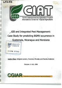
GIS and integrated pest management : Case study for predicting BGMV occurrence in Guatemala, Nicaragua and Honduras
Reports & Research
Diciembre, 1998
Guatemala
Nicaragua
Honduras
América central
América del Sur
Guía para la cartografía de niveles de restricción de los suelos, utilizando el sistema de información geográfica "MAP Maker Popular" y la hoja electrónica Excel
Manuals & Guidelines
Diciembre, 1999
Colombia
Hacia el bienestar de las comunidades forestales: guía para la acción de los gobiernos locales
Journal Articles & Books
Diciembre, 2007
Bolivia
Indonesia
Governments in many countries are decentralising to give more control over decision making and budgets to local administrations. One expectation of this change is that local governments will more effectively and efficiently respond to the poorest citizens in their jurisdictions. Decentralisation is especially significant to forest communities, which have historically benefited little from government services and poverty reduction programmes because of their physical isolation and social marginalisation.
HCI-Evaluation of the GeoCitizen-reporting App for citizen participation in spatial planning and community management among members of marginalized communities in Cali, Colombia
Journal Articles & Books
Diciembre, 2016
Colombia
América central
América del Sur
Increasingly, geospatial web applications such as www.fixmystreet.com or www.seeclickfix.com are being integrated within citizen participation processes in spatial planning and the provision of communal services. Recently, several of these platforms have been launched in Latin America and other countries of the Global South.
HCI-Evaluation of the GeoCitizen-reporting App for citizen participation in spatial planning and community management among members of marginalized communities in Cali, Colombia

Journal Articles & Books
Diciembre, 2016
Colombia
América central
América del Sur
Increasingly, geospatial web applications such as www.fixmystreet.com or www.seeclickfix.com are being integrated within citizen participation processes in spatial planning and the provision of communal services. Recently, several of these platforms have been launched in Latin America and other countries of the Global South.