Pasar al contenido principal

page search

Issues Forest Tenure related Project
Displaying 217 - 228 of 245

Rural Development and Modernization Project for the Central and Paracentral Region (PRODEMOR-CENTRAL)

General

The project aims to reduce significantly the current levels of poverty and extreme poverty of 6,600 households in 66 municipalities of the Central and Paracentral region through participative, community-driven, micro-watershed-centred, social and economic processes, following a deliberate action strategy of gender and intercultural equity, environmental sustainability and organisational and institutional strengthening. Land and natural resource governance interventions aim to support the achievement of cooperation agreements between land owners and land tenants, and territorial consolidation of indigenous communities.

Erosion Protection Program IV (PLAE)

General

The objective of the financial cooperation measure is: smallholders who are organized in user groups are able to manage erosion protection facilities and large-scale afforestation to generate household energy based on formalized land rights. Key achievements include helping program communities to develop land use plans (LNPs), build functioning land use certification, and support user groups in implementing large-scale forest and erosion control measures.

Southern Nyanza Community Development Project (SNCDP)

General

The project intended to reduce poverty and improve the livelihoods of 100,000 households in six districts: Homa Bay, Kuria, Migori, Nyamira, Rachuonyo and Suba, that are among the poorest districts in the relatively high-potential agricultural area around Lake Victoria. The project’s intermediate objective was to enhance gendered empowerment of the rural communities through improved health and more rational use and management of natural resources for sustainable livelihood activities. On land and natural resource governance, the project intended to enable in particular the poor and vulnerable groups to analyse their land tenure security situations and to establish contact with the District Land Office, Land Control Boards and Tribunals, chiefs and elders; it assisted the communities in installing a water supply scheme or rehabilitating their own scheme to meet the national standard set for per capita supply of water. 56 Participatory Rural Appraisal (PRA) processes were undertaken and community action plans developed through active community participation.

Poverty Reduction Project in Aftout South and Karakoro - Phase II (PASK II)

General

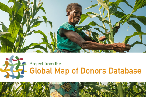
The project aims to improve incomes and living conditions for 21,000 households in the areas of Aftout South and Karakoro. The specific objective is to help build an economic and social fabric based on sustainable natural resource management that is inclusive of poor rural households, particularly women and young people. Land and natural resource governance related interventions include land agreements to guarantee equitable access to land which will be indispensable for any irrigation scheme and the adoption of an integrated watershed management approach. Land Tenure Arrangements, both large scale or on smaller areas, help stabilize use rights, to make them more fair and accessible for the target population.

“ENPARD Technical Assistance to the Ministry of Agriculture of the Republic of Armenia”

General

During 2017, FAO has under the FAO ENPARD project (GCP/ARM/006/EC) assessed the reasons for land abandonment, an emergent problem in Armenia, and prepared a Policy Note outlining a range of possible responses. The analysis revealed that land abandonment is a complex multi-dimensional process with interlinked economic, environmental, social factors causing it. The inability to irrigate (due to infrastructure constraints, economic constraints or for any other reasons) was found to be among the main drivers of land abandonment in Armenia. Thus, the multiple causality of land abandonment requires a coordinated policy response between agricultural policy, land policy and improvements in the irrigation sector. The policy note and the advise provided therein builds on the VGGT principles of good governance of tenure.

Agricultural Services Support Programme (ASSP)

General

The programme aims to contribute to economic diversification, reduction of rural poverty and food insecurity and improve livelihoods of approximately 20,000 farming households in the regions of Ngamiland, Chobe, North East, Central, Kgatleng, Kweneng, Southern and South East. The programme aims to achieve a viable and sustainable smallholder agricultural sector based on farming as a business, not reliant on subsidies or welfare measures, focusing on women and youth currently engaged, or potential new entrants, into smallholder agriculture. Land and natural resource governance interventions intend to strengthen participatory local land use planning in the identification, demarcation and planning of cluster farming areas. The programme aims to encourage the allocation of under-utilised land to landless women and youth while maintaining security of tenure of owners by strengthening rental agreements. Cluster Management Committees and Agricultural Management Associations will be established to strengthen group management of land.

Introduction of voluntary land consolidation in Ukraine in the context of opening land market, and as an instr

General

FAO is currently providing technical support to the Government of Azerbaijan (Ministry of Agriculture) with introduction of land consolidation instrument to address the problem of inefficient farm structures (small and fragmented) and boost agricultural transformation and development (Project reference: TCP/AZE/3601). The main objectives of the project are to develop a national land consolidation strategy, increase the institutional capacity to develop and implement modern land consolidation projects and implement a voluntary land consolidation project in a selected pilot area. Land consolidation activities are seen in a broader rural development context, because the needs and constraints the communities face are much broader than only farm structures. The Community Area Development Plan will be prepared in the process together with the local authorities and all interested local stakeholders. Land consolidation is being currently tested in the selected community and adapted in the process to the national context. The most suitable model will be developed in line with best international practices and the VGGT. Pilot experiences from the field project will feed into the Land Consolidation Strategy to be prepared in order to integrate land consolidation into broader policy framework.

Climate protection through forest conservation in Pacific Island States

General

The project aims to preserve forest ecosystems in the Pacific and thus contribute to climate change mitigation. To this end it is supporting three island states in creating the conditions necessary for par-ticipation in an international financing mechanism for reducing emissions from the forest sector (REDD+). Together with the partners it is developing REDD+ strategies and policies and boosting capabilities in the field of measurement, reporting and verification (MRV) at national level. At local level the project is working with communities and user groups to implement REDD+ pilot projects which directly protect the forest, while at regional level a coherent regional REDD+ policy is being developed. Apart from this the project is establishing a regional REDD+ information and support platform by setting up a virtual network of users and REDD+ specialists, installing a data platform and carrying out training for operating the network.

Implementation of SOLA system within MLE CC NR

General

The objective of the project is to develop an open source enterprise software application that supports core cadastre and registration functions. The project will provide support for the customization of the initial SOLA software and its implementation in Tonga. The project will establish an open source community of users and developers around the SOLA software and improve sustainability, efficiency and transparency.

Capacity Building for Improvement in Land Administration and Procedures in Bosnia Herzegovina (CILAP)

General

The “Capacity Building for Improvement of Land Administration and Procedures in Bosnia and Herzegovina” – CILAP project, is a long term project aimed to build capacity and transfer knowledge with the overall objective to increase the effectiveness and reliability of land administration processes in Bosnia and Herzegovina. From the beginning CILAP project is planned, described and approved for six (6) years period with the goal to support geodetic authorities in BH during the whole implementation period of Real Estate Registration Project (RERP), funded by World Bank loan. The Project contributes to expected long- term impact: -By efficient land administration contribute to economic and social development, sustainable market and usage of real estates, and BiH accession to EU. The expected impact will be reached if the project main goal is fulfilled, and it is: -Confidence in Geodetic Authorities in BiH strengthened through delivering of efficient services and providing of secure and reliable information to the customers.