Aller au contenu principal

page search

Issues Forest Tenure related Project
Displaying 181 - 192 of 245

Sustainable Forest Management in the Congo Basin - Environmental Foundation TNS.

General

As part of the development cooperation program "Sustainable Forest Management in the Congo Basin", the FC module contributes to the better protection and sustainable use of forest resources in the Congo Basin.

Technical Assistance to Land Use and Economic Development of Niayes Region

General

This project supports the Government of Senegal in developing a land use development plan for the Great Coast of Senegal (Niayes region). The plan is expected to serve as a land use management and development plan for an area that is one of the most agriculturally productive and highly sensitive environmentally. The plan also aims to support decision-making by Senegalese authorities in the long-term economic development of the agriculture, agroforestry, and forestry sectors, while taking into account environmental and land issues.

Introduction of voluntary land consolidation in Ukraine in the context of opening land market, and as an instr

General

The aim of the project was to introduce a voluntary land-consolidation approach in line with the Voluntary Guidelines on the Responsible Governance of Tenure of Land, Fisheries and Forests in the Context of National Food Security (VGGT). During the project FAO reviewed two versions of a draft Law on land consolidation prepared by StateGeoCadaster (SGC) and provided legal recommendations and advice how to review the drafts in line with best international practices and VGGT principles such as a key principle in land consolidation that participants should be at least as well off after the schemes as before. The legal advice provided was fully relying on the VGGT, and respecting the European Convention on Human Rights and the Human Rights the Convention on the Elimination of all forms of Discrimination Against Women (CEDAW). The Project contributed to SDG 1.4, 2.3, 5.A and 8.3 and emphasized the role of efficient farm structure and the land markets in attaining aforementioned SDG goals and at country level contributed to VGGT implementation. In addition to legal advise, a Feasibilty Study on in two communities was conducted to assess the demand and feasibility of land consolidation among the landowners and other stakeholders. A Concept Note was prepared outlinining the proposed approach for the implementation of the next steps towards a National Land Consolidation Programme in Ukraine including land consolidation pilots before scaling up to a national programme when the agricultural land market is opened. Finally, a guest lecture at the National University of Life and Environmental Sciences of Ukraine (NUBiP) about the VGGT, FAO land consolidation programme and the work conducted in Ukraine was delivered for master and PHD programmes’ students.

Mekong Region land governance

General

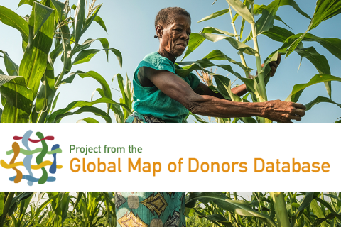
The Mekong region Land Governance programme aims at supporting farming families, especially those belonging to ethnic minorities, in securing their equitable access to, and control over agricultural land, forests and fisheries. The programme aims at strengthening the effectiveness of reform actors through learning, alliance building and regional cooperation with a view to assisting in the emergence of more equitable and sustainable policies and practices in the region.

Forest protection and the management of natural resources in Manu Biosphere Reserve, Peru

General

The purpose of the project is to conserve natural resources in Peru's Manu Biosphere Reserve, home to a unique and rich biological diversity. To this end, it assists the local population in managing natural resources. Measures include: utilisation agreements, development and dissemination of environmentally sound resource utilisation methods, reduction of human-wildlife conflict (for instance by setting up a hotline, building fences and conducting an environmental education campaign on the ecological function of wildlife) and delivering training for improved management of the Biosphere Reserve with increased codetermination by the representatives of local and indigenous groups. By preventing deforestation and supporting the natural regeneration of degraded areas, the project also contributes to climate change mitigation.

Real estate registration system for Moldova

General

The project consists of three main activities: •Support from the Norwegian Mapping Authority: The Norwegian Mapping Authority provides project supervision and technical assistance to the system design, development of ICT strategy, technical requirements and specification for procurements, and quality control and assurance of deliveries and installations. •Preparation of an overall ICT strategy for real estate registration (CADASTRU): The ICT strategy will facilitate the design and development of the system requirements, technical specifications and tender documents for the System procurements. •Development and implementation of a new Real Estate Registration System: Real estate information is an important component of a National Spatial Data Infrastructure, which Moldova will establish in conformity with the EU Inspire program for sharing and exchange of geographic data nationally and across national borders. The new IT solution for real estate registration will facilitate integrated access to a wide range of geographic information from various sources using web service; it will also be centralized. Local registration offices and external users will access the Central Database via Internet.

Regional programme to improve governance of tenure in Latin America and the Caribbean

General

The project aims at improving governance of tenure in the region by promoting research and policy dialogue on (i) access to land; (ii) monitoring governance; (iii) improving land administration; (iv) articulating public policies to ensure territorial development.

Sunamganj Community-Based Resource Management Project (SCBRMP)

General

The aim of the project was to increasing assets and income of 90.000 households in Sunamganj district by diversifying livelihood and employment opportunities. The objectives were to improve access to essential services and resources, including credit and to support the development of a viable national institution to replicate the project approach in other areas of Bangladesh. With regard to land and natural resource governance, the project intended to demarcate wetland and conservation areas, support reforestation measures and grant leases to 293 Beels (wetland) and other user groups.

Albanian-Norwegian hydrographic information project (ALNO_HIP)

General

The project will contribute to competence and capacity building for the Albanian Hydrographic Service (AHS) and the Military Geographical Institute (MIG). Both institutes are led by the Ministry of Defense. AHS is responsible for depth mapping and navigational marking (buoys, lights, etc.). Sea measurement activities are currently underfunded, with a lack of equipment and usable boats. Activities The Norwegian Mapping Authority is assisting AHS with the acquisition of multibeam solutions for processing and management of data. The project will also provide for the education of hydrographs, as well as the procurement and installation of two tide gauges. MGI is responsible for the production of sea and land maps, as well as the national geodetic network. MIG has a lot of good skills, but lacks modern equipment. Much of the support for this institute will be acquisition of production systems for ENCs and paper charts. Necessary upgrades to the network, server capacity and workstations will be included. A "production line" will be established that includes both institutes.

Global Land Tool Network Phase 2

General

The Global Land Tool Network (GLTN) was established in 2006 and brings together over 70 international institutions to promote secure land and property rights for all, through the development of pro-poor and gender-appropriate land tools. The goal of GLTN Phase 2 programme is to ensure that “international organizations, UN-Habitat staff and related land programmes/projects and targeted national and local governments are better able to improve tenure security of the urban and rural poor”. Phase 2 builds on the success of Phase 1 that ended in 2011. Phase 2 of the GLTN emphasizes prioritizing, pilot-testing and rolling out priority land tools and approaches at country level; integrating capacity development and training in tool development processes; implementing capacity development programmes and supporting tool implementation in targeted countries and/ or cities / municipalities; supporting advocacy and knowledge management efforts; and mainstreaming gender equality, youth responsiveness, human rights and grassroots engagement in land work.

Emergency Food Security and Rural Development Programme (EFSRDP / PUSADER)

General

The aim of the programme was to support the improvement of food security of approximately 121,000 households in the most food-insecure rural areas in the regions of Tahoua, Maradi and Tillabery, by restoring and developing their production capacity. The programme gives special attention to poor farmer and herder households that are highly exposed to recurrent food and livestock crises in the three targeted regions by developing and re-vegetating 400 ha of land and creating two grazing paths of about 90 km in the department of Aguié in the Maradi region. The programme supported the development of two pastoral areas of 300 ha in the department of Madarounfa (Maradi region) and the rehabilitation of 3000 ha of degraded lands. Land and natural resource governance related interventions provided support for negotiations of social agreements by which the owners were willing to allocate parcels to the most vulnerable groups. In the Maradi region this type of land agreements allow women's access to arable land.