Passar para o conteúdo principal

page search

IssuespecuáriosLandLibrary Resource
Displaying 685 - 696 of 838

Resource Atlas of Isiolo County, Kenya: Community-based mapping of pastoralist resources and their attributes

Reports & Research
Junho, 2015
Quênia

Participatory digital mapping using satellite imagery and digital earth and other open source Geographic Information Systems (GIS) is a practical tool bridging the knowledge and communication gap between pastoral communities and county government planners. It is offering an effective option for participatory planning and decision-making in support of climate change adaptation in the drylands of Kenya.

Booklet 2: Participatory Rangeland Planning: A Practitioners Guide

Journal Articles & Books
Fevereiro, 2013
Quênia

Garba Tula district in Isiolo County of Northern Kenya, is a region covering approximately 10,000km and home to around 40,000 predominantly Boran Pastoralists. The region is characterised by arid and semi-arid conditions and is rich in biodiversity and wildlife resources. Despite being surrounded by protected areas such as Meru National Park and Bisan Adi Game Reserve the full potential for conservation is not being met, and instead communities are often threatened and restricted by wildlife populations.

Harnessing Pastoralists’ Indigenous Range Management Knowledge for Drought -Resilient Livelihood Systems in the Horn of Africa

Conference Papers & Reports
Agosto, 2009
África

This report on harnessing pastoralists’ indigenous knowledge of rangeland management in three countries in East and the Horn of Africa is presented in two parts. The first part presents a review of the literature. The second presents the findings from the Orma in Tana River District of Kenya, the Afar in Amibara and Gawane Districts of the Afar Regional State in Ethiopia and the Karamojong in the Moroto District of Uganda.

Global livestock production systems

Journal Articles & Books
Dezembro, 2010
Global

Informed livestock sector policy development and priority setting is heavily dependent on a good understanding of livestock production systems. In a collaborative effort between the Food and Agriculture Organization and the International Livestock Research Institute, stock has been taken of where we have come from in agricultural systems classification and mapping; the current state of the art; and the directions in which research and data collection efforts need to take in the future.


Indigenous Peoples and the Extractive Sector

Conference Papers & Reports
Março, 2014
Global

This report provides an overview of the present state of play of the extractive industries in relation to indigenous peoples, taking as its point of departure the adoption of the UN Declaration on the Rights of Indigenous Peoples(UNDRIP) in 2007, together with the 2009 UN Permanent Forum on Indigenous Issues International (UNPFII) Expert Group Meeting on Extractive Industries, Indigenous Peoples’ Rights and Corporate Social Responsibility, and the 2009 International Conference on Indigenous Peoples and the Extractive Industries.

Social Impacts of Protected Areas on Gender in West Kilimanjaro, Tanzania

Journal Articles & Books
Janeiro, 2016
Tanzania

In most cases, the establishment of protected areas (PAs) goes hand-in-hand with an increase in conservation costs to communities living adjacent to these PAs. This paper draws insights from gender theories in particular feminist political ecology approach to unravel the impact of PAs on men and women around the Kilimanjaro National Park (NP) and the Enduimet Wildlife Management Area (WMA) in Tanzania. Specifically, it investigates how the creation and expansion of two PAs in Tanzania have impacted men and women in different ways.

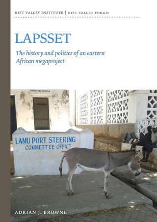
LAPSSET The history and politics of an eastern African megaproject

Conference Papers & Reports
Março, 2014
África

‘This study is in-depth, up-to-date and the first of its kind on a massive infrastructure development project in the region, examining its history, politics, evolution, the emergence of actors and interests and effects on the poor and marginalized. It presents the ambitions and ambiguities of a megaproject never seen in the development history of the region. The report is a comprehensive analysis of the hopes and fears emanating from a megaproject in the region and provides invaluable data on which future studies will certainly have to rely.’

Mapping Guidelines for Participatory Rangeland Management in Pastoral and Agro-Pastoral Areas

Manuals & Guidelines
Janeiro, 2015
Global

The purpose of these Mapping Guidelines is to support development practitioners (individuals and organizations) working in the rangelands and sub-humid grasslands of Ethiopia. Specifically, resource mapping can assist with investigating rangeland management systems, negotiating rangeland management plans, and implementing and monitoring progress in Participatory Rangeland Management (PRM). The Mapping Guidelines will provide rangeland management practitioners with a tool to help establish PRM within community, district, zone and regional rangeland management offices across Ethiopia.

Rapid Assessment of Returns on Investments in Natural Resource Stewardship

Reports & Research
Novembro, 2014
Quênia

The report summarizes the findings of a participatory assessment of returns on investments in strengthening customary institutions for natural resource stewardship in four wards of Isiolo over the long dry season of 2014. Due to the rapid timeframe for the assessment, many observed benefits were not yet quantified. However, those that could be appraised so far already outweighed the investments made through the Isiolo Climate Adaptation Fund and by the members of the local institutions.