By Daniel Hayward, reviewed by Maxim Gorgan, Land Tenure Officer at the United Nations Food and Agriculture Organisation
Armenia is a small, landlocked country in the Caucasus region. Covering a total land area of 29,740km2,1 the country borders Georgia to the north, which contains the best seaport options into the Black Sea. Azerbaijan is found to the east, Iran to the south, and Turkey to the west. It is a mountainous country of diverse climatic conditions, with limited land, forest and water resources.2 The country lies on a seismic belt, as demonstrated by the 1988 Spitak earthquake.
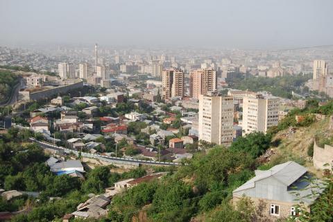
In the Soviet era, all land in Armenia was owned by the state. Agricultural land was set up into large cooperatives and state farms. Following the break-up of the Soviet Union, a speedy period of land reform took place from 1991-1993, privatizing land and providing it to citizens free of charge.
Armenia by Gill M License Attribution-ShareAlike 2.0 Generic (CC BY-SA 2.0)
Following defeat by Turks during World War I, in 1918 the independent Republic of Armenia was founded. This lasted only until 1920, when the territory was integrated into the Soviet Union as the Armenian Soviet Socialist Republic. For a time, the territory was part of the Transcaucasian Socialist Federative Soviet Republic, together with Georgia and Azerbaijan, before becoming a separate socialist republic in 19363.During the Soviet era, there was a significant increase in the urban population due to the growth of the industrial sector.
Armenia declared independence on 23rd August 1990, the country gaining full recognition in 1991 with the breaking up of the Soviet Union4 .Directly following independence, much state property was privatised, including land. However, due to a loss of markets and subsidised energy, the country initially suffered from a reduced industrial output, high unemployment and considerable emigration, troubles exacerbated through territorial conflict with Azerbaijan. The Gross Domestic Product fell 60% between 1989 and 1993. But from 1995 up to the 2008 global financial crisis, there was strong growth following liberalisation of foreign investment. In 2019, the country graduated to upper-middle income status.
In 2018, Serzh Sargsyan and his coalition government were toppled following protests known as the Velvet Revolution, and a revolutionary government under Nikol Pashinyan was put in place. Following defeat to Azerbaijan in the 2021 escalation of conflict, politics has become increasingly polarised. In snap elections held that year following a ceasefire of hostilities, Pashinyan’s Civil Contract party won a majority to retain power.
As of 1 January 2022, the population stood at 2,961,000, of which 98.1% were ethnic Armenians5. This represents a significant drop from a 1990 peak of over 3.5 million, due to post-independence emigration. Although around one third of the population lives in the capital city of Yerevan6, the rural population increased following independence, from 32% of total population in 1989 to 37% over the last decade7.Rural poverty is significantly higher than for urban areas. There remains a dependence on Russia who receive the bulk of exports, act as a security guarantor, and wield influence on energy, transport and communications sectors. Remittances remain high from an emigrant population. Armenia is a secular state, albeit one where the Christian faith plays a major role in identity of the people8. The country is presently split into ten provinces (marzes) and Yereven, the capital city.
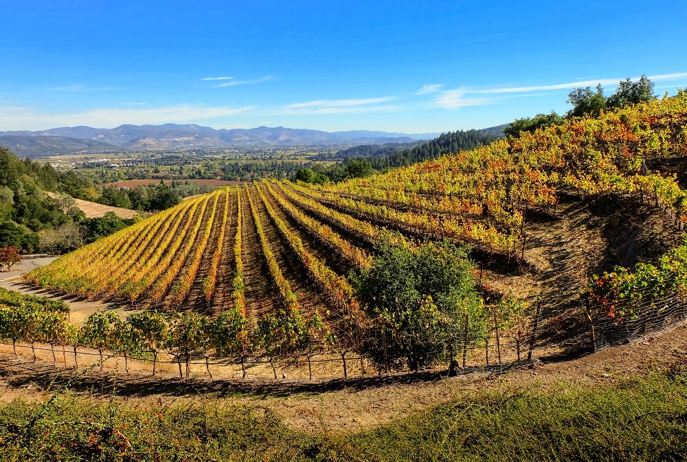
Ijevan vineyards, photo by Govorkov, Creative Commons Attribution 2.0 Generic license.
Land legislation and regulations
Article 31 of the Armenian Constitution (1995) states that everyone has the right to own, use, dispose of and inherit property, so long as it does not damage the environment or infringe the rights of other persons, society or the State. The 1995 Constitution also established communities as legal entities and able to own property9.
Around the time of independence various laws were employed to bring about the transition from public to private agricultural land ownership (i.e., privatisation). The Law on Property of the Republic of Armenia (1990) initially allowed privatisation of agricultural and residential land. The Law of Peasant Farms and Collective Peasant Farms Land Law (1991) gave further support to the agrarian sector in stipulating on the transition from collective agriculture to one based around privatised land.
A tractor in a field
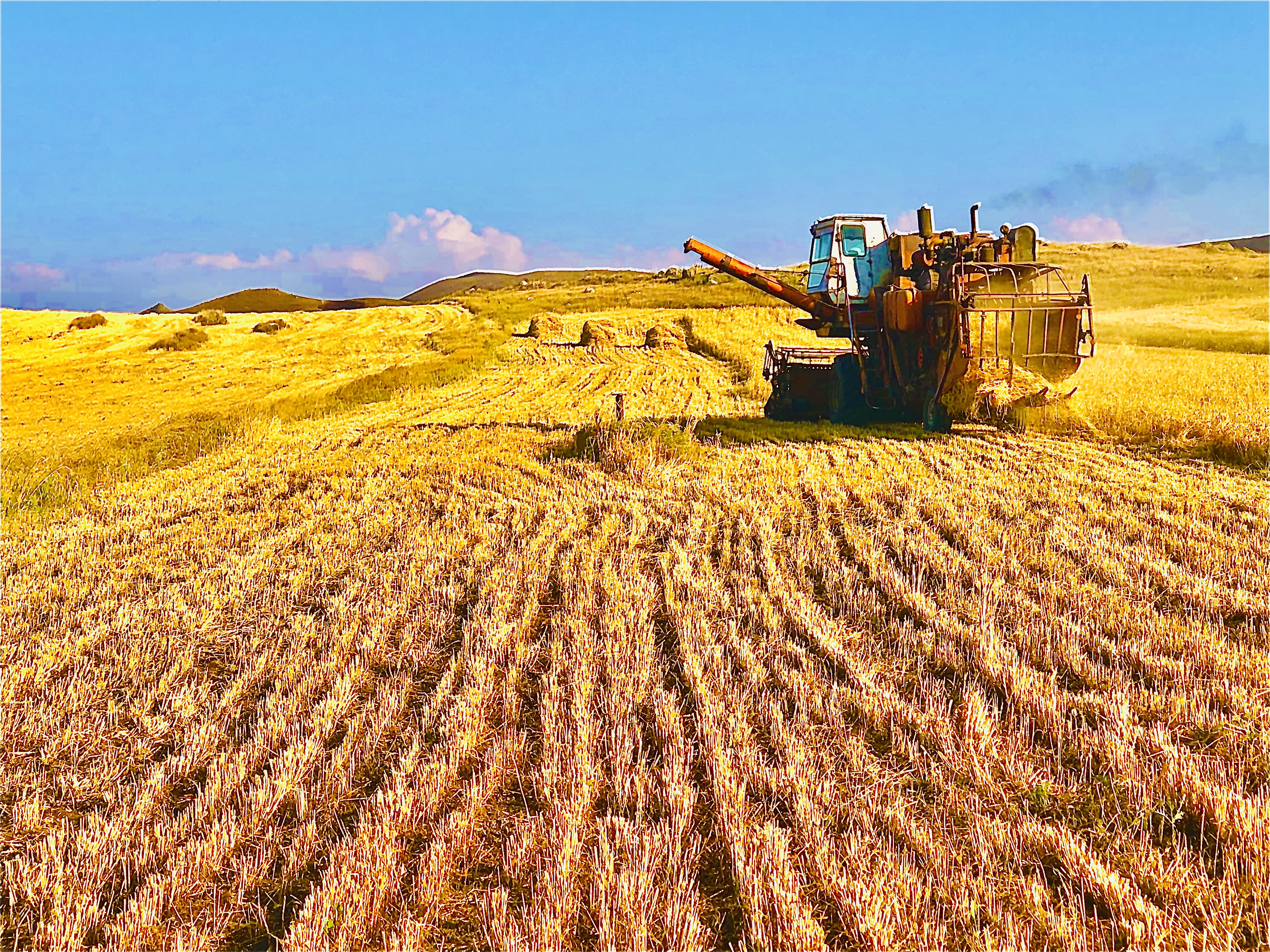
Wheat Fields of Shirak Province, Armenia, photo by Narek Avetisyan, Creative Commons Attribution-Share Alike 4.0 International license.
The 1991 Land Code then became the principle governing legislation on land, including permission to allocate private land. The Code regulates certain aspects of spatial planning although urban areas are subsequently covered by the Urban Development Law (1998)10 .A 2001 revision of the Code divided land into 9 categories (agricultural; settlements; industrial; energy, transport, communications, and public infrastructure; protected areas; land of special importance; forest; water; and land reserves)11. It also stipulates on the auction of state land and transfer to village-level control12.
Once much land had already been privatised, the Law on the Privatisation of State Property (1997) was brought in to focus on leftover state land and the privatisation of unfinished constructions. The Civil Code (1998) clarified the right to ownership of a dwelling (Article 222) and rights to occupancy under agreement with the homeowner (Article 225). The Code stipulates on how property may be acquired, used and terminated. The Law on the State Registration of Rights to Property (1999) governs land administration of property rights, recognising rights and providing systems to record and inform on land ownership and use, including a national cadastre.
The Forest Code (1994) contains provisions governing the sustainable management, rehabilitation, monitoring and protection of forest areas in Armenia. Article 4 states that forests can be under communal, state and private ownership. There are stipulations setting out rights and responsibilities in ownership, management bodies, classification, and management planning.
Land tenure classifications
In the Soviet era, all land in Armenia was owned by the state. Agricultural land was set up into large cooperatives and state farms13. Following the break-up of the Soviet Union, a speedy period of land reform took place from 1991-1993, privatizing land and providing it to citizens free of charge14 Agricultural land was distributed to rural families, where the number of parcels, which might include arable land, orchards, and vineyards, depended on the size of the family. Families with not more than three family members would receive one parcel, four to six members receiving two parcels, and more than six members receiving three parcels. The size of plots allocated varied depending on the state land fund and number of families in each community. The process created small farming households without sufficient knowledge, technical and input support, so that many families could barely maintain their livelihoods through subsistence-level cultivation.15 Around 265 (out of 869) collective farms continued operations, leasing state land.
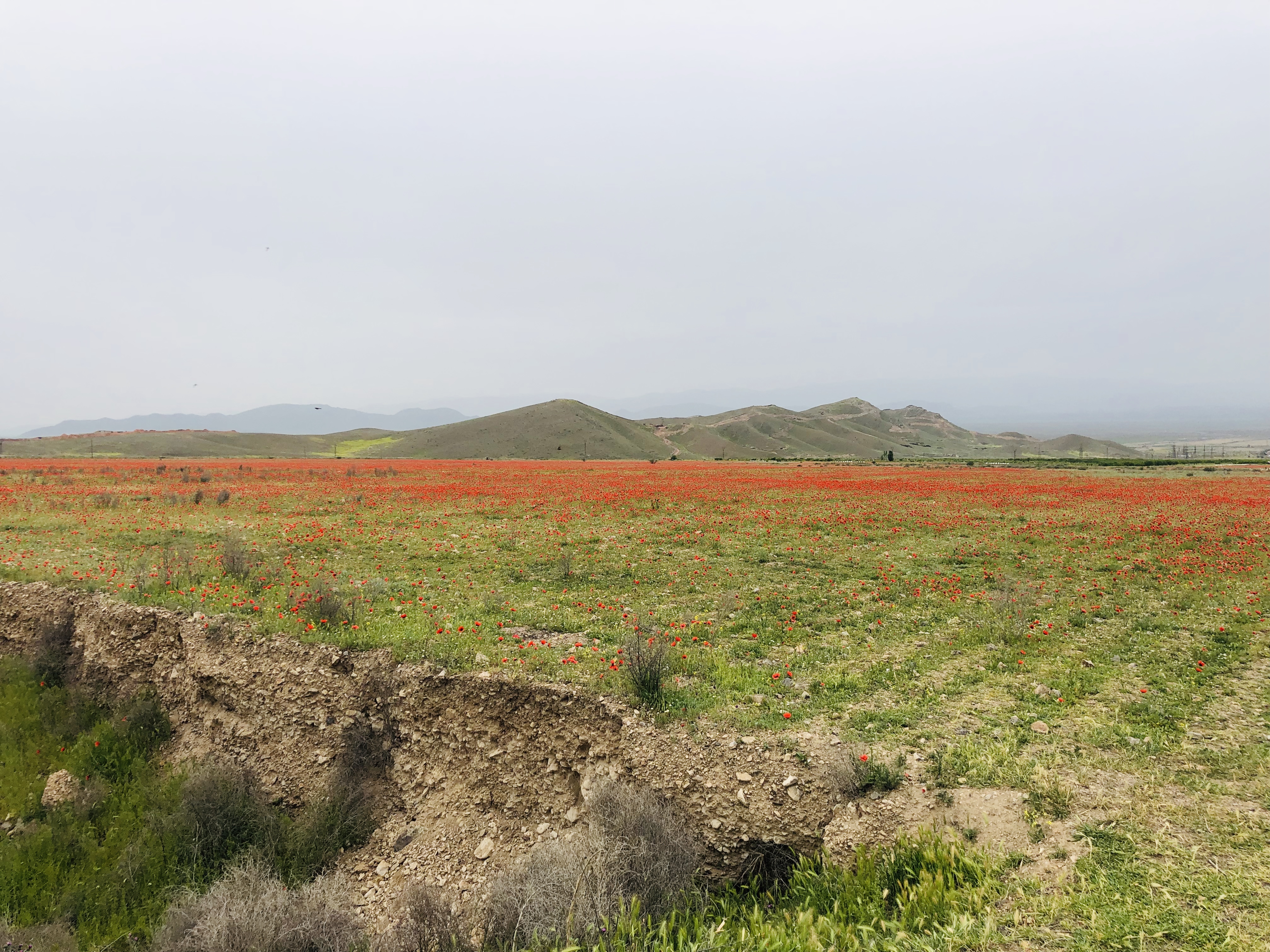
Tulip Fields in Armenia, photo by Narek Avetisyan, Creative Commons Attribution-Share Alike 3.0 Unported license.
The 2014 Agricultural Census reported 317,346 family farms, which contributed over 97% of agricultural output16.At the time of the census, 60% of farms had less than one hectare of agricultural land. Some farms increased in size, yet there is still evidence of further fragmentation, primarily due to the splitting of plots through inheritance practices or the purchase of scattered parcels.
Of other land, almost 100% of housing stock is now privately owned, facilitating the emergence of a real estate market17. Apartments were also privatised but the parcels upon which housing blocks stood were kept in public ownership18. However, the social housing stock has nearly disappeared altogether, and less wealthy homeowners have had issues maintaining the property they now own. Beyond extensive privatisation, 25% of agricultural land, mainly being pastures, was kept in state ownership, with potential to transfer to local authorities for common use by communities19. These areas are now managed by local community councils. All unregistered parcels belong to the state.
Through the 1999 Law on State Registration of Rights to Property Law, the State Committee of Real Estate Cadastre (SCREC) was established to handle the roughly 2.5 million land parcels, which are now nearly all registered in Armenia. There is an ongoing digitalisation of the cadastral system, laid out in Armenia’s Digital Transformation Agenda 2018-2030 and Digitization Strategy 2021-202520. While the central government sets tax rates on land, zoning is the responsibility of local authorities21.
Land use trends
FAOSTAT, the statistics database compiled by the UN Food and Agriculture Organisation, classes 56% of land in Armenia as being agricultural (2020 figure)22.However, only 11% of total land is categorised as being cropland (2020 figure), much of this found in the Ararat Valley along the south-west border of the country. Otherwise, the bulk of agricultural land comprise pastures through mountainous and hilly terrain23 .Despite a relatively small proportion of cropland, farming has long been a major source of employment in Armenia. According to estimates from the International Labour Organisation, between 1991 and 2015, the labour share in agriculture stood between 35 and 45%24 .By 2019 the figure had decreased to 24%, a lower but still significant proportion. The sector is vulnerable because of a relative shortage of suitable land coupled with access to sufficient water resources25.
Forests in Armenia take up to 11% of the total land area (2020 figure from FAOSTAT) and are state owned. The National Forest Policy and Strategy, enacted in 2015, was developed to guide forest and wildlife management, also supporting adaptation plans to climate change and restoration programmes26.
Despite a significant movement of the population to the countryside around the time of independence, the urban population of Armenia remains around 63% of the national total and is projected to increase to 75% by 205027. More than half of this urban population lives in the capital Yerevan. Yerevan and smaller cities generate 90% of GDP in Armenia, particularly through industry and tourism. However, only 3% of land is categorised as urban, with unplanned development has led to urban sprawl.
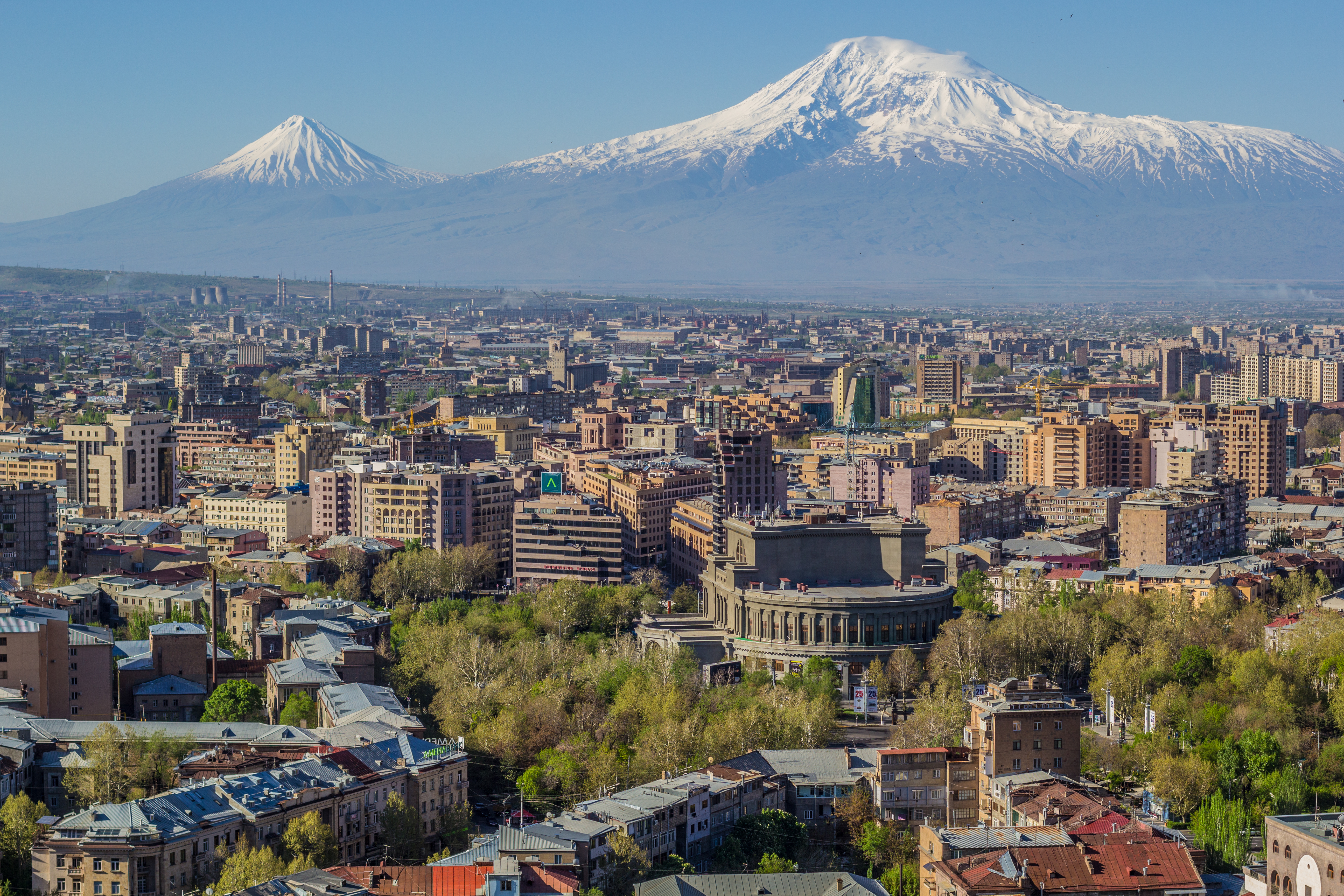
Mount Ararat and the Yerevan skyline, photo by Սէրուժ Ուրիշեան (Serouj Ourishian), Creative Commons Attribution-Share Alike 3.0 Unported license.
Armenia is prone to earthquakes. The 1998 Spitak earthquake devastated 40% of Armenia’s landscape, killing 25,000 people and leaving more than half a million homeless. Rebuilding property for these made homeless by the disaster proved a major challenge.
Around 80% of land suffers from some level of desertification28. As a result, Armenia was one of the first countries to sign the United Nations Convention to Combat Desertification. The risks of impacts resulting from climate change are also high, such as through heatwaves, drought, floods, and landslides29. This could shift the flow and availability of water resources, as well as leading to soil and land degradation, loss of forest cover, and eventually present a threat to food security.
Land investments and acquisitions
There are several limiting factors affecting Armenia’s ability to attract investment including geographical location, a lack of significant natural resources, and the negative influence of the Nagorno-Karabakh conflict. Incentives to draw in foreign direct investment (FDI)30 include:
- The establishment of Free Economic Zones
- A foreign investor can own 100% of any given company
- There are no sector specific or geographical restrictions on investments
Foreigners cannot own agricultural land in Armenia. However, it is possible for registered companies to own land even when owned by a foreigner. Russia remains the main investment partner.
According to the Constitution, the state can acquire land in the public interest. Although privatised land can be mortgaged and held as investment collateral, more interest has been placed on existing or potential real estate to be placed on the land31. In the agriculture sector, family farms mostly operate in subsistence agriculture, making them uncompetitive in national and international markets32. Domestically, there is a relatively well-functioning if not yet fully developed land market for agricultural land. For example, in 2016 around 1% of privately-owned agricultural land (4,535 hectares) was traded33. The small size of plots make land unattractive as collateral for banks. As a result, investment programmes tend to favour medium to large-sized farms and so smallholders are often left out when support is made available34. Mining is one of the few industrial sub-sectors to have grown since independence, able to attract foreign investment. This is despite maintaining only a small contribution to overall GDP at under 3%35. The main deposits found are in copper and gold. The sub-sector is governed by the Subsoil Code (2011). There are legal provisions in the Land and Civil Codes governing land use changes and transfers for mining projects. However, implementation of the law often fails to align with international standards, particularly in ensuring appropriate compensation and resettlement where private land is acquired36.
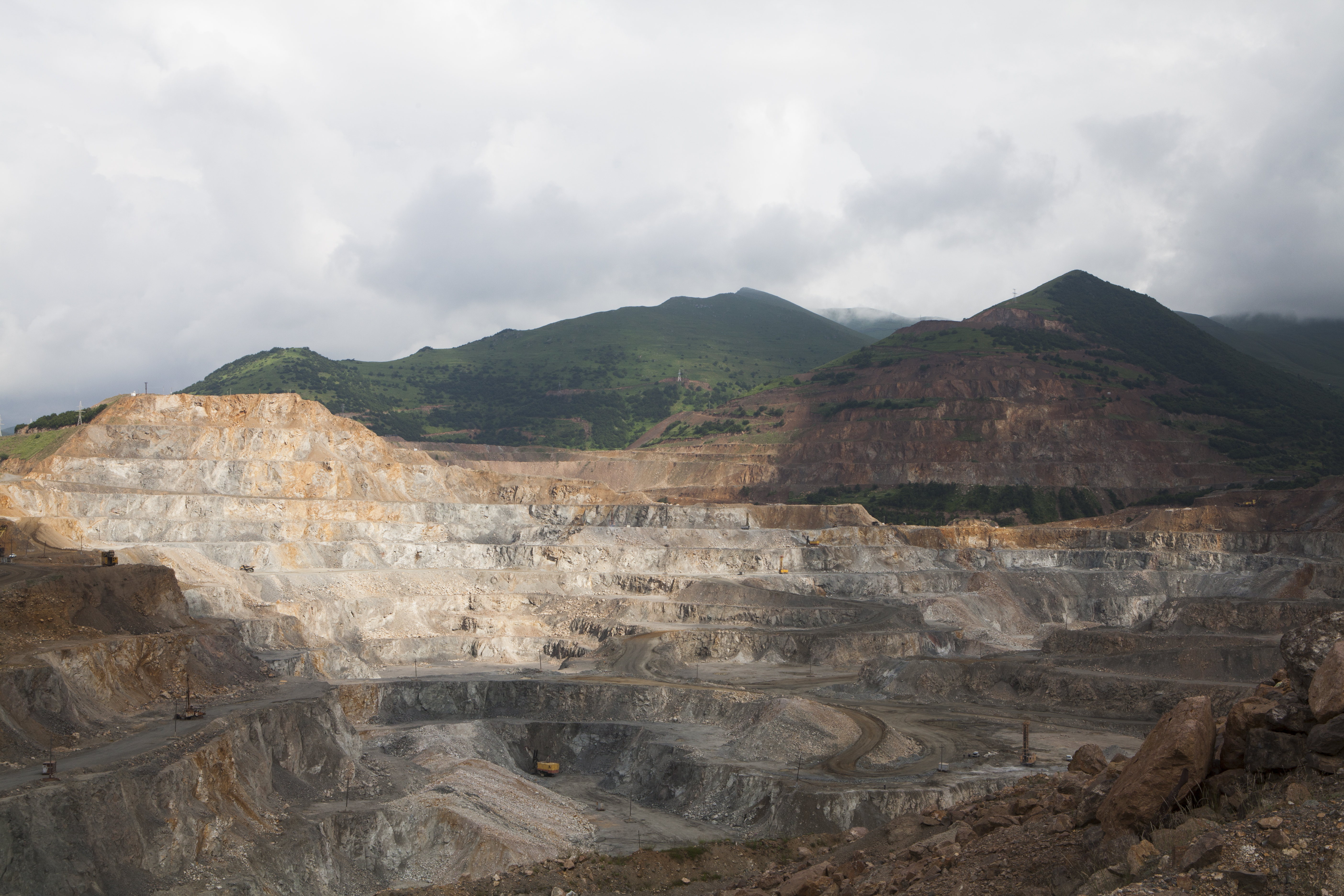
Karajan copper and molybdenum open-pit mine, the largest mine in Armenia found in the southern province of Syunik, photo by Serouj (courtesy of Pan-Armenian Environmental Front), Creative Commons Attribution-Share Alike 4.0 International license.
Territorial conflicts
Post-Soviet history in Armenia has been shrouded in an ongoing territorial conflict with Azerbaijan37. The conflict reflects ethnic and religious tensions, linking to population movements around the South Caucasus in the nineteenth and twentieth centuries. At the formation of the Soviet Union, the region of Nagorno–Karabakh, with a majority Armenian population, was placed as an autonomous republic within the Azerbaijan Soviet Socialist Republic. During glasnost (the Soviet policy of openness and transparency), Armenians explored the possibility of incorporating Nagorno–Karabakh into their republic, a move perceived by Azerbaijanis as representing a plan to take the land by force. In 1991, Nagorno–Karabakh declared itself an independent republic, leading to the First Karabakh War (1992-1994). When a ceasefire to this war was agreed in 1994, Armenia claimed most of Nagorno–Karabakh and surrounding districts, which comprised around 20% territory of pre-1991 Azerbaijan.
From 27th September to 20th November 2020, a new outbreak of conflict resulted in much territory taken by Armenia during the First Karabakh War being recaptured by Azerbaijan. Despite a subsequent ceasefire, a lasting peace agreement is yet to be signed, and the conflict continues to play out in various media beyond the battlefield. This ceasefire was facilitated by Russia through its role as a security guarantor in the region. In Armenia, this ceasefire resulted in loss of credibility for the national government, leading to protests and the storming of government buildings. New skirmishes broke out in September 2022, although they have yet to reach the levels of previous bouts of conflict38.
Women’s land rights
The Constitution of Armenia guarantees equal rights for both men and women. There is a Gender Equality Strategy 2019-2023. However, there is no specific government department with the power to enforce gender policy39. Indeed, according to a situational analysis by the UN Food and Agriculture Organisation, there is a gap between national legislation concerning gender and its implementation40, with inequalities found on the ground, including a major pay gap favouring men41.Married women tend to live with their husband and his family, and are as a result denied opportunities for land ownership both with their own families and those of their husbands. Inheritance trends tend to favour male over female relatives to receive land.
Roughly an equal number of men and women are involved as labour in the agricultural sector42. However, more women are involved in informal labour, which may be formally unrecognised and therefore influence a lack of access to training, technology and inputs. Land distributed during the reform period was registered to all family members. Yet the 2014 Agricultural Census of Armenia identified that 75% of households are headed by men43.
Land governance innovations
A consequence of post-independence land reform has been the structure of small agricultural landholdings, followed by further fragmentation of parcels. This has contributed to land abandonment in Armenia, involving about one third of total agricultural land, impeding productivity in the sector. Other factors leading to abandonment include migration, an aging rural population, and a lack of irrigation facilities. An FAO project up to the end of 2021, implemented in partnership with the Ministry of Economy, looked to address land abandonment44.The Project supported the formulation and operationalisation of a new regulatory framework aiming to enhance land utilisation and improve farm structures by reducing land fragmentation and facilitating farm enlargement on a voluntary basis. The draft law prepared with the support of the project introduced a set of institutional responsibilities and enabling provisions for land consolidation, land banking and lease facilitation instruments.
There has been concerted work around the issue of land degradation in Armenia, catalysed by the fact that around 80% of land suffers from some level of desertification45. The country has already put forward an action plan to achieve Land Degradation Neutrality (LDN) by 2030, including improved land use for crop production, forest plantations on degraded lands, and improved use of grasslands.[46] In 2020, the Armenian Soil Information System (ArmSIS) was launched, to better collate information on soil resources, thereby support policy decisions. In 2021, a Food and Agriculture Organisation-Global Environment Facility Project was launched to support LDN targets through sustainable land management and restoration of degraded landscapes.
A lack of organisation in Armenia’s pastures has led to overgrazing, land degradation, and a subsequent contraction in the livestock sector. While the government of Armenia decentralised the management of pastures, this was not backed up by financial investment and training. A Global Environment Facility (GEF)-funded Community Agricultural Resource Management and Competitiveness Project, which was implemented from 2011-2016, aimed to both improve the livelihoods of poor rural residents and also reverse land degradation in pastures47. This involved increasing livestock productivity, improving market connectivity, and creating a more effective pasture management system. The project targeted 55 mountain communities and included the formation of Pasture User Associations with technical support in their initial phase of operation. Upon completion, the project was deemed a success, demonstrating that the recovery of degraded pasturelands was possible within the lifetime of a single intervention.
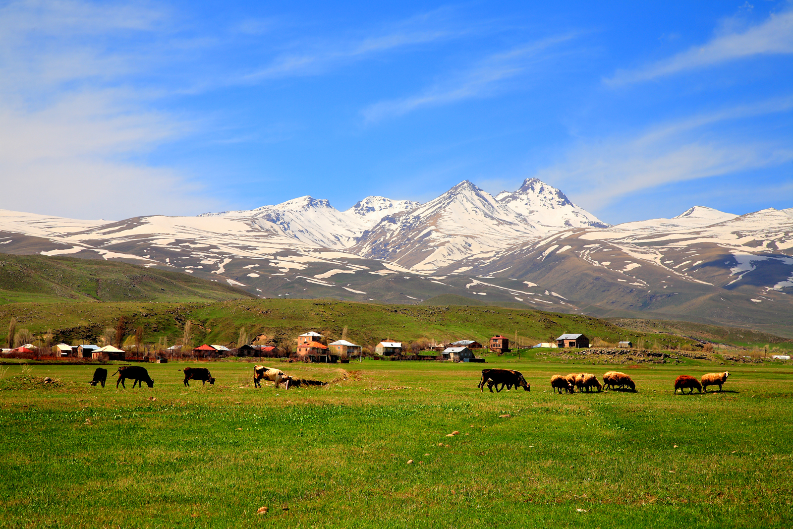
Pastures next to Aragats mountain, photo by Alexander Mkhitaryan B, Creative Commons Attribution-Share Alike 3.0 Unported license.
Where to go next?
The author's suggestion for further reading includes a Country Profile on Housing and Land Management, published by UNECE in 2017, with extensive information on urban development, land administration and land financing in Armenia48 .From the same year, the UN Food and Agricultural Organisation (FAO) provided a similarly thorough assessment on Gender, Agriculture and Rural Development in Armenia49 A view of the Rurality Crisis in Armenia can be found in the 2022 report from the Friedrich-Ebert-Stiftung.50 Concerning the ongoing territorial conflict between Armenia and Azerbaijan, Mozzafari and Barry produced a fascinating academic paper looking at how competing claims to land are manifested through carpet museums in each country51 .The paper is also included in a recent edition of Land Portal’s What to Read digest, Three territorial disputes you may not have heard of.
Timeline - milestones in land governance
1918 – Founding of Independent Republic of Armenia
1920 – Founding of Armenian Soviet Socialist Republic
Armenia integrated into the Soviet Union with land collectivised
1988 – Spitak earthquake
Devastated 40% of Armenia’s landscape, killing 25,000 people and leaving more than half a million homeless
1990 – Armenia declares independence
State gains full recognition in 1991 with the breaking up of the Soviet Union
1991 – Land Code enacted
Permitted allocation of private land, stipulating on land types and their governance
1991-3 – Land reform privatising land
Emergence of 324,000 family farms, and near universal privatisation of housing stock
1992-4 – First Karabakh War between Armenia and Azerbaijan
Territorial conflict over Nagorno–Karabakh region that continues to this day
1995 – Promulgation of the Armenian Constitution
Confirms rights to private land
References
[1] World Bank. (2022). World Bank Open Data. The World Bank: Working for a World Free of Poverty. https://data.worldbank.org/
[2]FAO. (2008). Country profile – Armenia (FAO Aquastat Reports). Food and Agriculture Organization of the United Nations. https://landportal.org/library/resources/faodocrepca0217en/country-profile-%E2%80%93-armenia
[3] UNECE. (2017). Country Profiles on Housing and Land Management: Republic of Armenia. United Nations Economic Commission for Europe. https://landportal.org/library/resources/country-profiles-housing-and-land-management-republic
[4] Millns, J. (2013). Agriculture and Rural Cooperation: Examples from Armenia, Georgia and Moldova. Food and Agriculture Organisation of the United Nations. https://landportal.org/library/resources/agriculture-and-rural-cooperation-examples-armenia-georgia-and-moldova
[5] GoA. (2022). About Armenia—Demographics. The Government of the Republic of Armenia. https://www.gov.am/en/demographics/
[6] World Bank Group, & ADB. (2021). Climate Risk Country Profile: Armenia. The World Bank Group and the Asian Development Bank. https://landportal.org/library/resources/climate-risk-country-profile-armenia
[7] World Bank. (2022). World Bank Open Data. The World Bank: Working for a World Free of Poverty. https://data.worldbank.org
[8] Bertelsmann Stiftung. (2022). BTI 2022 Country Report Armenia. Bertelsmann Stiftung. https://landportal.org/library/resources/bti-2022-country-report-armenia
[9] Alden Wily, L. (2018). Collective Land Ownership in the 21st Century: Overview of Global Trends. Land, 7(2) https://landportal.org/library/resources/103390land7020068/collective-land-ownership-21st-century-overview-global-trends
[10] ADB. (2019). Armenia’s Transformative Urban Future: National Urban Assessment (Armenia). Asian Development Bank. https://landportal.org/library/resources/armenia-transformative-urban-future
[11] UNECE. (2017). Country Profiles on Housing and Land Management: Republic of Armenia. United Nations Economic Commission for Europe. https://landportal.org/library/resources/country-profiles-housing-and-land-management-republic
[12] Lerman, Z. (2004). Successful Land Individualization in Trans-Caucasia: Armenia, Azerbaijan, Georgia. In D. Macey, W. Pyle, & S. Wegren (Eds.), Building Market Institutions in Post-Communist Agriculture: Land, Credit, and Assistance (pp. 53–75). Lexington Books. https://landportal.org/library/resources/successful-land-individualization-armenia-azerbaijan-georgia
[13] Hartvigsen, M. (2013). Land reform in Central and Eastern Europe after 1989 and its outcome in the form of farm structures and land fragmentation. Food and Agriculture Organisation of the United Nations. https://landportal.org/node/48483
[14] Wehrmann, B. (2010). Governance of Land Tenure in Eastern Europe and Commonwealth of Independent States (CIS) (No. 16; Land Tenure Working Paper). Federal Ministry for Economic Cooperation and Development (GTZ), FAO. https://landportal.org/resource/babette-wehrmann/governance-land-tenure-eastern-europe-and-commonwealth-independent-states-
[15]Habibov, N. (2012). Income inequality and its driving forces in transitional countries: Evidence from Armenia, Azerbaijan and Georgia. Journal of Comparative Social Welfare, 28(3), 209–221. https://www.tandfonline.com/doi/abs/10.1080/17486831.2012.749504?journalCode=rjcs20
[16] Gorgan, M., Hartvigsen, M., & Grigoryan, V. (2017). Policy Note on land abandonment and recommendations for policy advice on introduction of a land consolidation instrument in Armenia. Food and Agriculture Organisation of the United Nations. Unpublished.
[17] UNECE. (2017). Country Profiles on Housing and Land Management: Republic of Armenia. United Nations Economic Commission for Europe. https://landportal.org/library/resources/country-profiles-housing-and-land-management-republic
[18] UNECE. (2001). Land Administration Review: Armenia. United Nations Economic Commission for Europe. https://landportal.org/library/resources/land-administration-review-armenia
[19] Hartvigsen, M. (2013). Land reform in Central and Eastern Europe after 1989 and its outcome in the form of farm structures and land fragmentation. Food and Agriculture Organisation of the United Nations. https://landportal.org/node/48483
Lerman, Z. (2004). Successful Land Individualization in Trans-Caucasia: Armenia, Azerbaijan, Georgia. In D. Macey, W. Pyle, & S. Wegren (Eds.), Building Market Institutions in Post-Communist Agriculture: Land, Credit, and Assistance (pp. 53–75). Lexington Books. https://landportal.org/library/resources/successful-land-individualization-armenia-azerbaijan-georgia
[20] SNV. (2022). Armenia Country Profile. Stiftung Neue Verantwortung. https://landportal.org/organization/stiftung-neue-verantwortung
[21] ADB. (2019). Armenia’s Transformative Urban Future: National Urban Assessment (Armenia). Asian Development Bank. https://landportal.org/library/resources/armenia-transformative-urban-future
[22] FAOSTAT. (2022). FAOSTAT database. Food and Agriculture Organization of the United Nations. http://www.fao.org/faostat/en/
[23] Spoor, M. (2012). Agrarian reform and transition: What can we learn from ‘the east’? The Journal of Peasant Studies, 39(1), 175–194. https://landportal.org/library/resources/agrarian-reform-and-transition-what-can-we-learn-east
[24] World Bank. (2022). World Bank Open Data. The World Bank: Working for a World Free of Poverty. https://data.worldbank.org/
[25] Vermishyan, H., Vartikyan, A., Gevorgyan, E., Michikyan, S., & Ghalamdryan, A. (2022). Rurality Crisis in Armenia. Friedrich-Ebert-Stiftung Armenia. https://landportal.org/library/resources/rurality-crisis-armenia
[26] World Bank Group, & ADB. (2021). Climate Risk Country Profile: Armenia. The World Bank Group and the Asian Development Bank. https://landportal.org/library/resources/climate-risk-country-profile-armenia
[27] UN. (2020). World Urbanization Prospects 2019. United Nations Department of Economic and Social Affairs Population Dynamics. https://population.un.org/wpp/
UNECE. (2017). Country Profiles on Housing and Land Management: Republic of Armenia. United Nations Economic Commission for Europe. https://landportal.org/library/resources/country-profiles-housing-and-land-management-republic
[28] UNDP. (2017). Community Approaches to Sustainable Land Management and Agroecology Practices. United Nations Development Programme. https://landportal.org/node/98559
[29] World Bank Group, & ADB. (2021). Climate Risk Country Profile: Armenia. The World Bank Group and the Asian Development Bank. https://landportal.org/library/resources/climate-risk-country-profile-armenia
[30] Kaczmarek-Khubnaia, J. (2017). Foreign Direct Investment in Armenia. Journal of Geography, Politics and Society, 7(4), https://landportal.org/library/resources/foreign-direct-investment-armenia
[31] UNECE. (2017). Country Profiles on Housing and Land Management: Republic of Armenia. United Nations Economic Commission for Europe. https://landportal.org/library/resources/country-profiles-housing-and-land-management-republic
[32] Gorgan, M., Hartvigsen, M., & Grigoryan, V. (2017). Policy Note on land abandonment and recommendations for policy advice on introduction of a land consolidation instrument in Armenia. Food and Agriculture Organisation of the United Nations. Unpublished.
[33] Gorgan, M., & Hartvigsen, M. (2022). Development of agricultural land markets in countries in Eastern Europe and Central Asia. Land Use Policy, 120.
[34] Vermishyan, H., Vartikyan, A., Gevorgyan, E., Michikyan, S., & Ghalamdryan, A. (2022). Rurality Crisis in Armenia. Friedrich-Ebert-Stiftung Armenia. https://landportal.org/library/resources/rurality-crisis-armenia
[35] World Bank. (2016). Armenia: Strategic Mineral Sector Sustainability Assessment. World Bank. https://landportal.org/library/resources/handle1098624756/armenia
[36] ibid
[37] Bertelsmann Stiftung. (2022). BTI 2022 Country Report Armenia. Bertelsmann Stiftung. https://landportal.org/library/resources/bti-2022-country-report-armenia
[38] Holmes, O. (2022, September 13). About 100 troops killed in clashes between Armenia and Azerbaijan. The Guardian. https://www.theguardian.com/world/2022/sep/13/deadly-clashes-erupt-in-disputed-territory-between-azerbaijan-and-armenia
[39] Bertelsmann Stiftung. (2022). BTI 2022 Country Report Armenia. Bertelsmann Stiftung. https://landportal.org/library/resources/bti-2022-country-report-armenia
[40] FAO. (2017). Gender, agriculture and rural development in Armenia. Food and Agriculture Organisation of the United Nations. https://landportal.org/library/resources/gender-agriculture-and-rural-development-armenia
[41] ADB. (2019). Armenia’s Transformative Urban Future: National Urban Assessment (Armenia). Asian Development Bank. https://landportal.org/library/resources/armenia-transformative-urban-future
[42] Vermishyan, H., Vartikyan, A., Gevorgyan, E., Michikyan, S., & Ghalamdryan, A. (2022). Rurality Crisis in Armenia. Friedrich-Ebert-Stiftung Armenia. https://landportal.org/library/resources/rurality-crisis-armenia
[43] ARMSTAT. (2019). Women and Men in Armenia. The Statistical Committee of the Republic of Armenia (ARMSTAT). https://landportal.org/library/resources/women-and-men-armenia
[44]FAO. (2022). Establishment of Land Management Instruments and Institutional Framework to Address Land Abandonment. Food and Agriculture Organisation of the United Nations. https://landportal.org/library/resources/establishment-land-management-instruments-and-institutional
[45]UNDP. (2017). Community Approaches to Sustainable Land Management and Agroecology Practices. United Nations Development Programme. https://landportal.org/node/98559
[46] FAO. (2021). LDN in Armenia. Food and Agriculture Organisation of the United Nations. https://landportal.org/library/resources/ldn-armenia
[47] World Bank. (2017). Implementation Completion and Results Report (IDA-48910) on a Credit in the Amount of SDR 10.3 million (US$16.0 million equivalent) to the Republic of Armenia for a Community Agricultural Resources Management and Competitiveness Project. World Bank Group. https://www.thegef.org/projects-operations/projects/4954
[48] UNECE. (2017). Country Profiles on Housing and Land Management: Republic of Armenia. United Nations Economic Commission for Europe. https://landportal.org/library/resources/country-profiles-housing-and-land-management-republic
[49] FAO. (2017). Gender, agriculture and rural development in Armenia. Food and Agriculture Organisation of the United Nations. https://landportal.org/library/resources/gender-agriculture-and-rural-development-armenia
[50] Vermishyan, H., Vartikyan, A., Gevorgyan, E., Michikyan, S., & Ghalamdryan, A. (2022). Rurality Crisis in Armenia. Friedrich-Ebert-Stiftung Armenia. https://landportal.org/library/resources/rurality-crisis-armenia
[51] Mozaffari, A., & Barry, J. (2022). Heritage and territorial disputes in the Armenia–Azerbaijan conflict: A comparative analysis of the carpet museums of Baku and Shusha. International Journal of Heritage Studies, 28(3), 318–340. https://landportal.org/library/resources/heritage-and-territorial-disputes-armenia
Authored on
27 April 2023
