page search

Issuesland coverLandLibrary Resource
There are 2, 240 content items of different types and languages related to land cover on the Land Portal.
Displaying 2125 - 2136 of 2218

Abandonment and Recultivation of Agricultural Lands in Slovakia—Patterns and Determinants from the Past to the Future

Peer-reviewed publication
September, 2020
Eastern Europe

Central and Eastern Europe has experienced fundamental land use changes since the collapse of socialism around 1990. We analyzeanalyzed the patterns and determinants of agricultural land abandonment and recultivation in Slovakia during the transition from a state-controlled economy to an open-market economy (1986 to 2000) and the subsequent accession to the European Union (2000 to 2010).

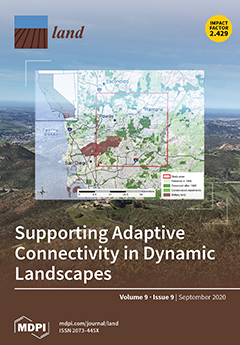
Land-Use Change and Future Water Demand in California’s Central Coast

Peer-reviewed publication
September, 2020
Australia
Brazil
Trinidad and Tobago
United States of America

Understanding future land-use related water demand is important for planners and resource managers in identifying potential shortages and crafting mitigation strategies. This is especially the case for regions dependent on limited local groundwater supplies. For the groundwater dependent Central Coast of California, we developed two scenarios of future land use and water demand based on sampling from a historical land change record: a business-as-usual scenario (BAU; 1992–2016) and a recent-modern scenario (RM; 2002–2016).

Warming Effort and Energy Budget Difference of Various Human Land Use Intensity: Case Study of Beijing, China

Peer-reviewed publication
September, 2020
China
Norway
Russia
United States of America

Human land use intensity affects the surface energy balance by changing the biogeophysical parameters. This study used Moderate Resolution Imaging Spectroradiometer remote sensing data and surface energy balance algorithms to quantify changes in surface energy budgets corresponding to changes in land use in Beijing from 2000 to 2015. Land use was reclassified by considering land use intensity. The difference in the latent heat flux (LE) and net radiation (Rn) (LE−Rn) expressed the warming or cooling effect.

Land Cover Influences on LST in Two Proposed Smart Cities of India: Comparative Analysis Using Spectral Indices

Peer-reviewed publication
September, 2020
India
British Indian Ocean Territory
Norway

Elucidating the impact of Land Surface Temperature (LST) is an important aspect of urban studies. The impact of urbanization on LST has been widely studied to monitor the Urban Heat Island (UHI) phenomenon. However, the sensitivity of various urban factors such as urban green spaces (UGS), built-up area, and water bodies to LST is not sufficiently resolved for many urban settlements.

Highlighting the Sustainability Implications of Urbanisation: A Comparative Analysis of Two Urban Areas in Ghana

Peer-reviewed publication
September, 2020
Ghana
Sub-Saharan Africa

Ghana is urbanising rapidly, and over half of the country’s population have lived in urban areas since 2010. Although research has proliferated to explore Ghana’s urbanisation, there is a dearth of research that holistically explores the wider sustainability implications of urbanisation, offers comparative perspectives in the context of large and smaller urban areas, and provides a perspective of local level urbanisation in the context of resource extraction (mining).

Remotely-Sensed Surface Temperature and Vegetation Status for the Assessment of Decadal Change in the Irrigated Land Cover of North-Central Victoria, Australia

Peer-reviewed publication
September, 2020
Australia

Monitoring of irrigated land cover is important for both resource managers and farmers. An operational approach is presented to use the satellite-derived surface temperature and vegetation cover in order to distinguish between irrigated and non-irrigated land. Using an iterative thresholding procedure to minimize within-class variance, the bilevel segmentation of surface temperature and vegetation cover was achieved for each irrigation period (Spring, Summer and Autumn).

Adaptation to Land Degradation in Southeast Vietnam

Peer-reviewed publication
August, 2020
Vietnam
Norway

A framework was developed to elucidate (1) the drivers of land degradation, (2) pressures, (3) local impacts and vulnerabilities and (4) adaptation strategies. The combination of participatory approaches, statistical data analysis, time series Landsat imagery and spatial data mining was tested in southeast Vietnam where the impacts of land degradation on the environment and economy are considerable. The major drivers of land degradation are climate, notably drought, and population density. The pressures include natural resource management and land use/cover change.

Four Decades of Land-Cover Change on the Kenai Peninsula, Alaska: Detecting Disturbance-Influenced Vegetation Shifts Using Landsat Legacy Data

Peer-reviewed publication
September, 2020
Global

Across Alaska’s Kenai Peninsula, disturbance events have removed large areas of forest over the last half century. Simultaneously, succession and landscape evolution have facilitated forest regrowth and expansion. Detecting forest loss within known pulse disturbance events is often straightforward given that reduction in tree cover is a readily detectable and measurable land-cover change. Land-cover change is more difficult to quantify when disturbance events are unknown, remote, or environmental response is slow in relation to human observation.

Modelling Land Cover Changes in Peri-Urban Areas: A Case Study of George Town Conurbation, Malaysia

Peer-reviewed publication
September, 2020
Eastern Asia
Malaysia

Drastic growth of urban populations has caused expansion of peri-urban areas—the transitional zone between a city and its hinterland. Although urbanisation may bring economic opportunities and improve infrastructure in an area, uncontrolled urban expansion towards peri-urban areas will negatively impact the environment and the community living within the area. Malaysia, for example, has become one of the most urbanised countries in East Asia. However, cities in Malaysia are relatively small and less densely populated compared with other cities in East Asia.

Land Use/Land Cover Changes and the Relationship with Land Surface Temperature Using Landsat and MODIS Imageries in Cameron Highlands, Malaysia

Peer-reviewed publication
September, 2020
United States of America
Malaysia
Norway

Mountainous regions are more sensitive to climatic condition changes and are susceptible to recent increases in temperature. Due to urbanization and land use/land cover (LULC) issues, Cameron Highlands has been impacted by rising land surface temperature (LST) variation. Thus, this study was carried out to explore the impact of the LULC change on LST in the Cameron Highlands from 2009 to 2019 using remote sensing images acquired from Landsat 7 ETM+, Landsat 8 Operational Land Imager (OLI/TIRS), and Moderate Resolution Imaging Spectroradiometer (MODIS) 11A Thermal sensors.

Crowdsourcing LUCAS: Citizens Generating Reference Land Cover and Land Use Data with a Mobile App

Peer-reviewed publication
October, 2020
Europe
Norway
Austria

There are many new land use and land cover (LULC) products emerging yet there is still a lack of in situ data for training, validation, and change detection purposes. The LUCAS (Land Use Cover Area frame Sample) survey is one of the few authoritative in situ field campaigns, which takes place every three years in European Union member countries. More recently, a study has considered whether citizen science and crowdsourcing could complement LUCAS survey data, e.g., through the FotoQuest Austria mobile app and crowdsourcing campaign.

Are Vegetation Dynamics Impacted from a Nuclear Disaster? The Case of Chernobyl Using Remotely Sensed NDVI and Land Cover Data

Peer-reviewed publication
October, 2020
Global

There is a growing interest for scientists and society to acquire deep knowledge on the impacts from environmental disasters. The present work deals with the investigation of vegetation dynamics in the Chernobyl area, a place widely known for the devastating nuclear disaster on the 26th of April 1986.