page search

Displaying 109 - 120 of 123

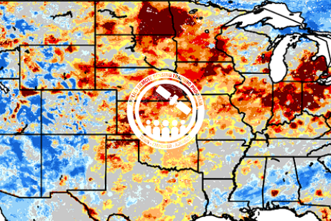
Application of NASA SPoRT-Land Information System (SPoRT-LIS) Soil Moisture Data for Drought

16 May 2023 - 30 May 2023

NASA’s Applied Remote Sensing Training Program (ARSET) has opened a new open, online webinar series: Application of NASA SPoRT-Land Information System (SPoRT-LIS) Soil Moisture Data for Drought. This 3-part webinar series is focused on the introduction of the NASA Land Information System (LIS) output of soil moisture at various depths for drought analysis and monitoring. Examples from operational applications as well as practice exercises (for using LIS data for drought monitoring) will be included in this course. Access to the SPoRT-LIS products via online viewer, in GIS formats, and GIS-based display tools, will also be included. Moreover, self-paced microlessons will be available to help users confirm their understanding and improve their skill via homework lessons between live sessions.

Assessing the Impacts of Fires on Watershed Health

05 July 2023 - 12 July 2023

NASA’s Applied Remote Sensing Training Program (ARSET) has opened a new open, online webinar series: Assessing the Impacts of Fires on Watershed Health. This advanced-level, three-part training will focus on using remote sensing observations for monitoring post-fire impacts on watershed health. Specifically, this training will highlight uses of NASA Earth observations (EO) for pre-fire land cover mapping, watershed delineation and stream mapping, post-fire burn severity mapping, and pre- and post-fire riverine and freshwater water quality.

Monitoring Water Quality of Inland Lakes using Remote Sensing

17 July 2023 - 24 July 2023

NASA’s Applied Remote Sensing Training Program (ARSET) has opened a new open, online webinar series: Monitoring Water Quality of Inland Lakes using Remote Sensing. This advanced-level training will focus on using remote sensing observations from Landsat 8 and 9, Sentinel-2, and Sentinel-3 for assessing water quality parameters, including chlorophyll-a concentration, turbidity, and Total Suspended Solids (TSS) in inland lakes. This training will also highlight the importance of in situ measurements of these parameters, coincident with satellite observations, in developing methodologies for operational water quality monitoring.

Seventh India Land and Development Conference: Land-People Relations Diversity and Transitions

31 October 2023 - 02 November 2023
Pune, Maharashtra
India

The India Land and Development Conference (ILDC) is an annual destination of diverse land actors and enthusiasts from the Global South. Since its inception in 2017, ILDC has brought together over 2500 participants from more than 70 countries, engaging in vital discussions on crucial land-related issues. This unique collective-led international conference has been a catalyst for partnerships, collaborative research, and action, contributing significantly to building a symbiotic land ecosystem in India.


NRMC
Flame University

Transforming Earth Observation (EO) Data into Building Infrastructure Data Sets for Disaster Risk Modeling

02 October 2023 - 09 October 2023

NASA’s Applied Remote Sensing Training Program (ARSET) has opened a new open, online, intermediate webinar series: Transforming Earth Observation (EO) Data into Building Infrastructure Data Sets for Disaster Risk Modeling. This three-part training, presented in English and Spanish, is open to the public and will cover the basics of natural hazard risk modeling and exposure development with a focus on fusing data from multiple datasets expressly for the purposes of risk assessment.  We will also present examples applying the techniques to applications related to flood risk assessment, climate adaptation, and earthquake modeling.

Large Scale Applications of Machine Learning using Remote Sensing for Building Agriculture Solutions

04 March 2024 - 18 March 2024

NASA’s Applied Remote Sensing Training Program (ARSET) has opened a new open, online webinar series: Large Scale Applications of Machine Learning using Remote Sensing for Building Agriculture Solutions. Remote sensing data is becoming crucial to solve some of the most important environmental problems, especially pertaining to agricultural applications and food security. Participants will become familiar with data format and quality considerations, tools, and techniques to process remote sensing imagery at large scale from publicly available satellite sources, using cloud tools such as AWS S3, Databricks, and Parquet. Additionally, participants will learn how to analyze and train machine learning models for classification using this large source of data to solve environmental problems with a focus on agriculture. 


Introduction to Lightning Observations and Applications

25 March 2024 - 01 April 2024

NASA’s Applied Remote Sensing Training Program (ARSET) has opened a new open, online webinar series: Introduction to Lightning Observations and Applications. This three-part, introductory training focuses on global and regional lightning data products that can be applied to disaster risk preparedness.

As the intensity and frequency of extreme weather events are likely to increase due to climate change impacts, lightning activity will likely increase as well, causing more power outages, increased risks of wildfire ignition, and increased numbers of injuries and fatalities. Therefore, information about lightning activity is critical for better preparedness against these disasters.

The Challenges of Citizen Participation in Land Governance in 21st Century Africa and Launch of the NELGA Central Africa Alumni Network

17 June 2024 - 19 June 2024
Hôtel TOU'NGOU
Carrefour Etoa Meki
Yaounde
Cameroon

This seminar will be an opportunity to deepen and consolidate the various issues raised in the initial contributions proposed for the collective work. Participants will have the opportunity to explore in depth the fundamental issues related to citizen participation in land governance, with a focus on the specific challenges faced in Africa. In-depth discussions will analyze the root causes of land problems, identify gaps in existing public policies, and formulate concrete proposals for effective reforms. Furthermore, the seminar will provide a platform for a comprehensive analysis of the role of alumni as an essential component of NELGA's sustainability in the sub-region and ends up with a setting up and launching of the NELGA AC alumni network

IATI Community Event 2024

22 April 2024 - 25 April 2024
National Administrative Department of Statistics (DANE)
Carrera 59, # 26 - 60
Bogota
Colombia

The IATI Members' Assembly and Community Exchange 2024 are taking place in Bogotá, Colombia.

International Aid Transparency Initiative

Earth Observations for Humanitarian Applications

05 June 2024 - 19 June 2024

NASA’s Applied Remote Sensing Training Program (ARSET) has opened a new open, online webinar series: Earth Observations for Humanitarian Applications. Refugees, internally displaced people (IDPs), and other displaced populations are made more vulnerable to climate change impacts due to their socio-political marginalization. This three-part, intermediate training presents concrete strategies for mapping localized climate conditions with risks faced by refugee and IDP communities around the world.

The training will focus on flood risk assessments and specific challenges for assessing flood risk in refugee and IDP camps; gauging long-term heat stress in refugee camps and the challenges with decision making surrounding heat risk; and monitoring drought effects on agricultural landscapes in refugee settings using Earth observations (EO) to explore the correlations between anomalies in crop productivity and weather-based factors


World Environment Day

04 June 2024

From tree planting in the Maldives and Kenya to the unveiling of large-scale city murals in the United States and activities in zoos across Ireland, Singapore and India, millions of people are coming together to mark this year’s Day.

United Nations Environment Programme