page search

Issuesland coverLandLibrary Resource
There are 2, 240 content items of different types and languages related to land cover on the Land Portal.
Displaying 1873 - 1884 of 2218

Which catchment characteristics control the temporal dependence structure of daily river flows?

Journal Articles & Books
December, 2015

Hydrological classification systems seek to provide information about the dominant processes in the catchment to enable information to be transferred between catchments. Currently, there is no widely agreed‐upon system for classifying river catchments. This paper develops a novel approach to classifying catchments based on the temporal dependence structure of daily mean river flow time series, applied to 116 near‐natural ‘benchmark’ catchments in the UK. The classification system is validated using 49 independent catchments.

benefits of considering land cover seasonality in multi-spectral image classification

Journal Articles & Books
December, 2012

Effects of incorporating multi-seasonal information into image classifications for large-scale land cover mapping are investigated. Data from four Landsat7 ETM+ scenes (March, May, June 2002, September 1999) were included step-wise into classifications by discriminant analysis to document their relevance for classification accuracy. The classification using all four images reached a maximum accuracy of 69.2%, significantly higher compared with single-date classifications and showing less fluctuations in classification accuracy.

Land-cover changes of biome transition zones in Loess Plateau of China

Journal Articles & Books
December, 2013
China

The Holdridge life zone (HLZ) model has been improved to help classify the biome transition zone (BTZ) in China's Loess Plateau. A positive and negative transformation index of land-cover (PNTIL) was developed to quantitatively evaluate the land-cover changes in every type of BTZ. Three bioclimatic datasets, with a spatial resolution of 1km×1km, were used to classify the BTZ type in Loess Plateau. These include the mean annual biotemperature (MAB), average total annual precipitation (TAP) and potential evapotranspiration ratio (PER).

Humans, bees, and pollination services in the city: the case of Chicago, IL (USA)

Journal Articles & Books
December, 2014
United States of America

Despite the global trend in urbanization, little is known about patterns of biodiversity or provisioning of ecosystem services in urban areas. Bee communities and the pollination services they provide are important in cities, both for small-scale urban agriculture and native gardens. To better understand this important ecological issue, we examined bee communities, their response to novel floral resources, and their potential to provide pollination services in 25 neighborhoods across Chicago, IL (USA).

Trapped between antiquity and urbanism – a multi-criteria assessment model of the greater Cairo Metropolitan area

Journal Articles & Books
December, 2011
Egypt

You can tell whether a man is clever by his answers.You can tell whether a man is wise by his questions.Naguib MahfouzThis article attempts to provide systematic policy information regarding land use/land cover change in the vicinity of the Giza Pyramids in Egypt.

Estimating vertical error of SRTM and map-based DEMs using ICESat altimetry data in the eastern Tibetan Plateau

Journal Articles & Books
December, 2011
China

The Geoscience Laser Altimeter System (GLAS) instrument onboard the Ice, Cloud and land Elevation Satellite (ICESat) provides elevation data with very high accuracy which can be used as ground data to evaluate the vertical accuracy of an existing Digital Elevation Model (DEM). In this article, we examine the differences between ICESat elevation data (from the 1064 nm channel) and Shuttle Radar Topography Mission (SRTM) DEM of 3 arcsec resolution (90 m) and map-based DEMs in the Qinghai-Tibet (or Tibetan) Plateau, China.

Urban expansion into a protected natural area in Mexico City: alternative management scenarios

Journal Articles & Books
December, 2013

Land use change is one of the main stress factors on ecosystems near urban areas. We analysed land use dynamics within Xochimilco, a World Heritage Site area in Mexico City. We used satellite images and GIS to quantify changes in land use/land cover (LULC) from 1989 to 2006 in this area, and a Markov projection model to simulate the impact of different management scenarios through to 2057. The results show an alarming rate of urbanisation in 17 years. LULC change runs in one direction from all other land use categories towards urban land use.

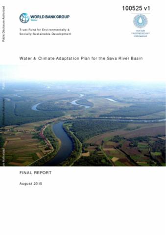
Water and Climate Adaptation Plan for the Sava River Basin

Reports & Research
Training Resources & Tools
August, 2015
Bosnia and Herzegovina
Croatia
Serbia
Slovenia
Montenegro
Eastern Europe
Europe
Central Asia

This report presents the water and climate adaptation plan (WATCAP) developed for the Sava river basin (SRB) as result of a study undertaken by the World Bank. The WATCAP is intended to help to bridge the gap between the climate change predictions for the SRB and the decision makers in current and planned water management investment projects that will be affected by changing climate trends.

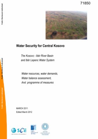
Water Security for Central Kosovo

Reports & Research
Policy Papers & Briefs
March, 2012
Kosovo
Europe
Central Asia

Kosovo is a small and young state that gained an interim United Nations (UN)-administered status in the wake of the Dayton peace accord only in 1999; it declared independence in 2008. Compared to neighboring countries, it is still lacking in its basic infrastructure and its administrative and technical skills. In addition, with the onset of the War in Yugoslavia in 1992 most investment and normal maintenance came to a standstill.

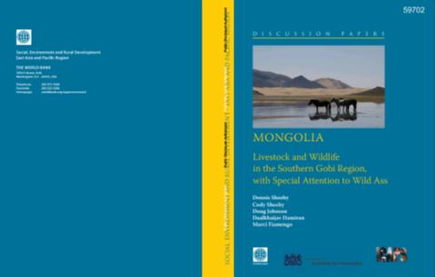
Mongolia

Reports & Research
Training Resources & Tools
Policy Papers & Briefs
August, 2010
Mongolia
Eastern Asia
Oceania

The purpose of this report is to examine development trends in the Southern Gobi Region (SGR) as they affect livestock and wildlife. It provides an overview of the environment and natural resources of the region, discusses existing relationships and interactions among humans, livestock, large herbivore wildlife, and the natural resources on which they are dependent. It then explores the impact that economic development of the region is likely to have if that development does not consider the needs of the current users.

Mongolia

Reports & Research
Training Resources & Tools
December, 2009
Mongolia
Eastern Asia
Oceania

The economic value of the Upper Tuul ecosystem in Mongolia reports on a study carried out under the auspices of the World Bank and the Government of Mongolia. The goal of the study was to improve understanding about the economic value of the Upper Tuul ecosystem for Ulaanbaatar's water supplies and how this might be affected by different land and resource management options in the future.

Mongolia

Reports & Research
Training Resources & Tools
January, 2010
Mongolia
Eastern Asia
Oceania

The primary objective of the Southern Gobi Regional Environmental Assessment (REA) is to provide guidance for sustainable management of environmental resources in the future development of the Southern Gobi Region (SGR), development that will be led by rapid expansion of mining.