land cover
AGROVOC URI: http://aims.fao.org/aos/agrovoc/c_37897
Valor nutritivo y consumo selectivo del Desmodium ovalifolium CIAT 350
En la Estacion Experimental "Quilichao", del Centro Internacional de Agricultura Tropical (CIAT), depto. del Cauca, Colombia, se realizo un ensayo para evaluar el valor nutritivo y el consumo selectivo de Desmodium ovalifolium CIAT 350. Se usaron ovinos machos enteros de la raza Africanos, con un peso metabolico (P0.75) entre 7.89-9.77, a los cuales se suministro forraje fresco de D. ovalifolium a niveles de 30.245 g de MS/P(0.75) y de 5 edades de corte: 50, 80, 100, 125 y 145 dias; el ultimo corte coincidio con el inicio de la estacion seca.
Valuing the role of living aquatic resources to rural livelihoods in multiple-use, seasonally-inundated wetlands in the Yellow River Basin of China, for improved governance
Supported by the CPWF, this two-year project titled “Valuing the role of living aquatic
resources to rural livelihoods in multiple-use, seasonally-inundated wetlands in the
Yellow River Basin of China, for improved governance” focused on linking the use of
wetlands resources by local communities and value of wetlands ecosystem services with
management implications for the riverine and coastal wetlands in Henan and Shandong
provinces. A study on this Chinese situation of pursuing a rapid development agenda
Water-use accounts in CPWF basins: Simple water-use accounting of the Karkheh Basin
This paper applies the principles of water-use accounts, to the Karkheh River basin in Iran.
The northern part of the Basin where the Karkheh and its tributaries rise is mountainous, cooler, and wetter. The River spills out on to the hotter, lower semi-arid plains at its southern end. Precipitation, mainly in winter, varies from 400-500 mm in the upper part of the Basin falling to about 230 mm in the lower reaches.
Water-use accounts in CPWF basins: Simple water-use accounting of the São Francisco Basin
This paper applies the principles of water-use accounts, developed in the first of the
series, to the São Francisco basin in South America. The São Francisco Basin lies wholly
within Brazil. There are several major dams and wetlands in the Basin.
Net runoff is about 16% of total precipitation. Grassland is the most extensive land use,
covering 59% of the Basin and uses 48% of the water. Rainfed agriculture covers 23%
of the basin, but uses 14% of the water in the Basin. Forest and woodland cover 16% of
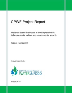
Wetlands-based livelihoods in the Limpopo basin: Balancing social welfare and environmental security
This report is a synthesis of research implemented for the project on Wetlands-based livelihoods in the Limpopo basin: balancing social welfare and environmental security. The research was motivated by the dependency of many people on wetlands for their livelihoods. It was therefore founded on the basis that the potential of wetlands to contribute to livelihoods is closely related to their ability to maintain ecosytem functions (such as regulating river flows), which is a consequence of their unique hydrological characteristics.
Post-War Land Cover Changes and Fragmentation in Halgurd Sakran National Park (HSNP), Kurdistan Region of Iraq
Context: The fundamental driving force of land use and land cover (LULC) change is related to spatial and temporal processes caused by human activities such as agricultural expansion and demographic change. Landscape metrics were used to analyze post-war changes in a rural mountain landscape, the protected area of Halgurd-Sakran National Park (HSNP) in north-east Iraq. Therefore, the present work attempts to identify the temporal trends of the most fragmented land cover types between two parts of the national park.
Monitoring and Analysing Land Use/Cover Changes in an Arid Region Based on Multi-Satellite Data: The Kashgar Region, Northwest China
In arid regions, oases ecosystems are fragile and sensitive to climate change, and water is the major limiting factor for environmental and socio-economic developments. Understanding the drivers of land use/cover change (LUCC) in arid regions is important for the development of management strategies to improve or prevent environmental deterioration and loss of natural resources.
Land Use and Land Cover Changes and Their Effects on the Landscape of Abaya-Chamo Basin, Southern Ethiopia
This study uses a combination of remote sensing data, field interviews and observations, and landscape indices to examine the dynamics of land use and land cover (LULC), identify their driving forces, and analyze their effects on the landscape of Abaya-Chamo Basin (ACB) between 1985, 1995, and 2010. The results reveal that the landscape of ACB has changed considerably during the past 25 years between 1985 and 2010. The main changes observed imply a rapid reduction in shrubland (28.82%) and natural grassland (33.13%), and an increase in arable land (59.15%).
Urban Land Cover Change in Ecologically Fragile Environments: The Case of the Galapagos Islands
The Galapagos Islands are a unique sanctuary for wildlife and have gone through a fluctuating process of urbanization in the three main inhabited islands. Despite being colonized since the 1800s, it is during the last 25 years that a dramatic increase in population has been observed. Analyzing impervious surface change over this period in an ecologically fragile environment is a challenging task, thus two methods that have been widely employed in studying urban environments were compared in this study: sub-pixel using spectral mixture analyses (SMA) and object-based classification.
Mapping Urban Green Infrastructure: A Novel Landscape-Based Approach to Incorporating Land Use and Land Cover in the Mapping of Human-Dominated Systems
Common approaches to mapping green infrastructure in urbanised landscapes invariably focus on measures of land use or land cover and associated functional or physical traits. However, such one-dimensional perspectives do not accurately capture the character and complexity of the landscapes in which urban inhabitants live. The new approach presented in this paper demonstrates how open-source, high spatial and temporal resolution data with global coverage can be used to measure and represent the landscape qualities of urban environments.
Forest Cover Change, Key Drivers and Community Perception in Wujig Mahgo Waren Forest of Northern Ethiopia
This study assessed forest cover change from 1985 to 2016, analyzed community perception on forest cover change and its drivers, and suggested possible solutions in northern Ethiopia. Landsat images of 1985, 2000 and 2016, household interviews and focus group discussions were used. While dense forests and open forests increased by 8.2% and 32.3% respectively between 1985 and 2000, they decreased by 10.4% and 9.8% respectively from 2000 to 2016. Grasslands and cultivated land decreased in the first period by 37.3% and 5.5% but increased in the second period by 89.5% and 28.5% respectively.

