page search

Issuesurban areasLandLibrary Resource
Displaying 3085 - 3096 of 3131

Habitat III National Report Tanzania

Reports & Research
June, 2016
Tanzania

Tanzania implemented extensive policy, legislative and structural reforms taken
and taken several other measures to fulfil her commitments to the Habitat II
Agenda. Yet achieving the objectives of "shelter for all" and "sustainable human
settlements in an urbanizing world" has remained elusive, due to financial and
human resource limitations of the urban authorities and rapid urbanization. Lack
of access to affordable housing, finance, land and services has resulted in most of

Conakry: un modèle de ville coloniale française? Règlements fonciers et urbanisme, de 1885 aux années 1920 (Conakry: A Model of French Colonial Town? Landrights and Town-Planning, from 1885 to the 1920s)

Journal Articles & Books
November, 1985
Guinea

The dynamics of land occupation in Conakry is approached from the angle of both the colonial authorities and the local dwellers. The former took upon themselves the power of allocating plots and strove to enforce a colonial urban pattern. The latter succeeded in partly appropriating the town in spite of the minutiae of the law. As the urban area extended, Conakry was divided into three zones according to an ordinance of 1905. Although the third zone was officially termed 'native', there were no ethnic or national criteria.

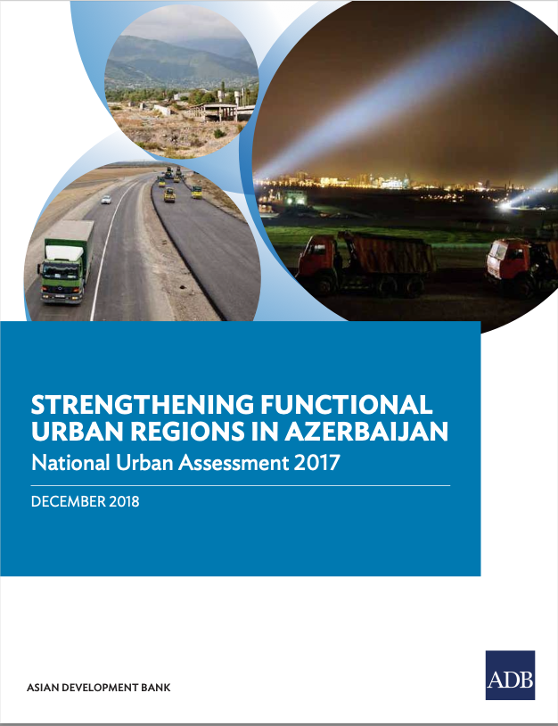
Strengthening Functional Urban Regions in Azerbaijan

Reports & Research
November, 2018
Azerbaijan

This publication helps guide investment planning and financing across key urban infrastructure sectors of Azerbaijan. It aims to improve the performance of cities—with a focus on economy, equity, and environment. The National Urban Assessment for Azerbaijan is among a series prepared by ADB for selected developing countries under its Urban Operational Plan 2012–2020.

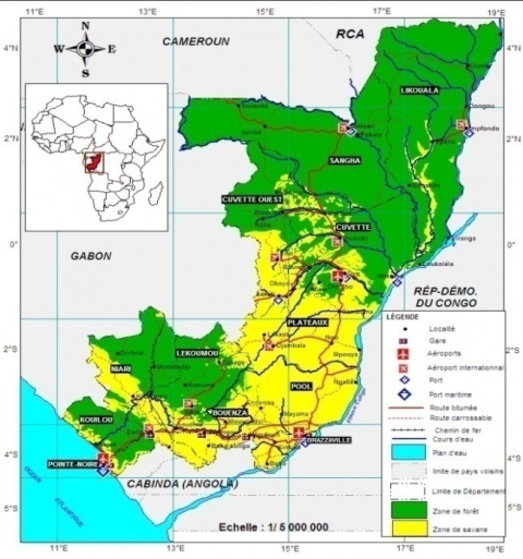
Impact de la gestion foncière sur les espaces agricoles périurbaine à Madingou (Sud-Ouest du Congo)

Journal Articles & Books
July, 2020
Congo

À Madingou, la question de la gestion foncière se pose avec acuité, car le développement des espaces urbains empiète sur les terres dévolues à l’agriculture périurbaine. Ce phénomène reconnu par les autorités municipales et les populations est à la fois à l’origine de la croissance anarchique de la ville et au rétrécissement préoccupant des superficies agricoles périurbaines. L’objectif de cette étude est d’analyser l’impact de la gestion foncière sur l’agriculture périurbaine à Madingou. Elle est réalisée entre janvier et mars 2017.

Emerging Livelihood Vulnerabilities in an Urbanizing and Climate Uncertain Environment for the Case of a Secondary City in Thailand

Journal Articles & Books
April, 2018
Thailand

ncreasing flood risks in Thailand are leading to new challenges for flood management and subsequently for livelihoods, which are still significantly agricultural. Policy makers prefer building flood protection infrastructure over utilizing non-structural measures like urban planning regulations to mitigate risks. We argue that unplanned urbanization intensifies flood risks and livelihood vulnerability and may even create new poverty patterns in peri-urban areas.

Site Evaluation of Eco-towns using GIS and Analytical Hierarchy Process: Case of Greater Kampala Metropolitan Area

Peer-reviewed publication
November, 2018
Uganda

Uganda’s total population is projected to increase to 61 million by 2040 in the rations of 37million (60%) to 24million (40%) in the Urban to rural areas respectively. Due to population expansion, Kampala as any other urban area is facing the problems of unplanned rapid growth such as: congestion, unplanned slums amongst others. The Kampala Physical Development Plan pointed out the need to develop new satellite eco-towns in the Greater Kampala Metropolitan Area of Ssisa and Mpatta to contain population explosion and reduce on the problems being experienced in the city.

LE FONCIER EN MAURITANIE : SITUATION, DÉFIS ET QUÊTE D’ADAPTATION

Peer-reviewed publication
August, 2019
Africa

FONCIER EN MAURITANIE : SITUATION, DÉFIS ET QUÊTE D’ADAPTATION(Article scientifique)Par Dr Ousmane WAGUE, coordinateur du master « Migrations, gouvernance foncière et territoriale »Université de Nouakchott Al Asria      SommaireLE FONCIER EN MAURITANIE : SITUATION, DÉFIS ET QUÊTE D’ADAPTATION.. 1RÉSUMÉ DE L’ARTICLE.. 3INTRODUCTION.. 41.    Rappel et situation des données. 4a.     Aperçu sur la situation du foncier en Mauritanie. 4b. Le défi de la fiabilité des données. 52.    Le foncier rural 63. Le foncier urbain. 94.Les grands défis de la gouvernance foncière. 124.1. Quelques constats.

Causes and Spatial Implications of violating Building Space Standards in Mwanza (Rock) City: Case of Mahina Settlement.

Peer-reviewed publication
November, 2018
Tanzania

Urban centres emerge, develop and expand. In the course of development or expansion, housing development on hilly landscapes may be more challenging than on relatively flat or flat terrains, forcing developers not to comply with building standards.

Informality in Urban Areas, a Case of Land Use Transformation in Mlalakuwa Settlement, Dar es Salaam

Peer-reviewed publication
February, 2020
Africa

Land use development and transformation in informal settlements have been taking place because informal settlements have been alternative way of providing affordable housing to low income people. Many governments use strict regulations to deny informal settlements from infrastructure services but in Tanzania informal settlements are provided with such services. This paper presents the findings on how land use transformation is taking place and publicly used spaces disappear overtime in the informal settlements, the context behind and their outcomes.

Urban topo climatic factors effects on heating Islands based on high-resolution Digital Surface Models

Peer-reviewed publication
December, 2020
Africa

Urban surface morphology is an important key factor in determining the temporal variation of thermal anisotropy. This study uses drones based high-resolution Digital Surface Models (DSM) to explore the impact of morphological urban variability expressed by terrain factors such as diurnal anisotropy patterns, sky view factor, solar radiation and solar duration effects on the urban heating island. The goal of this study is to build a topo-climatologic map from the terrain factors and determine its effects on the Urban Heating Islands.